place

Newburgh Bay

Bays of New York (state)Beacon, New YorkBodies of water of Orange County, New YorkCornwall, New YorkHudson River
New Windsor, New YorkNewburgh, New York
Newburgh Bay
Newburgh Bay

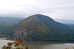
Newburgh Bay is a feature of the Hudson River's west bank, located approximately 60 miles (105 km) north of New York City. It takes its name from the city of Newburgh, New York, for many years the major port on this section of the river. Towns on the bay are Newburgh, New York; New Windsor, New York and Cornwall, New York, all in Orange County. The Roseton and Danskammer power plants are located at the north end of the bay, in the town of Newburgh. The bay is not a protected inlet, but rather a widening of the river with a maximum depth of 80 feet (20 m). It begins roughly at the Hudson Highlands near the village of Cornwall-on-Hudson, New York, and extends some 10 miles north to Danskammer Point. Between the city of Newburgh, Orange County on the west bank and Beacon, Dutchess County on the east, the river is almost 2 miles (3.2 km) in width. While not as wide as Haverstraw Bay to the south, the bay makes the river wide enough that it was the last section of the Hudson to be bridged. The Newburgh–Beacon Bridge opened in November 1963. The recently restored Newburgh–Beacon Ferry makes passenger-only trips between the two cities during commuting hours in the morning and evening for riders on the Metro North Hudson Line's Beacon station.

Excerpt from the Wikipedia article Newburgh Bay (License: CC BY-SA 3.0, Authors, Images).

Newburgh Bay
Wee Bay Steps,

Geographical coordinates (GPS) Address Nearby Places
placeShow on map

Wikipedia: Newburgh BayContinue reading on Wikipedia

Geographical coordinates (GPS)

Latitude Longitude
N 41.455 ° E -73.986 °
placeShow on map

Address

Bannerman Castle (Bannerman's Island Arsenal)

Wee Bay Steps
12520
New York, United States
mapOpen on Google Maps

Newburgh Bay
Newburgh Bay
Share experience

Nearby Places

Dutchess Manor
Dutchess Manor

Dutchess Manor was a restaurant and catering hall located along NY 9D in the Town of Fishkill, New York, United States, between the city of Beacon and Breakneck Ridge. It is one of the most distinctive Hudson Valley buildings in the Second Empire architectural style, and was added to the National Register of Historic Places in 1982. In 2020, the building was purchased by Hudson Highlands Fjord Trail, a nonprofit organization behind the planning of a 7.5-mile linear park in the Hudson Highlands. Francis Timoney, an Irish immigrant, built the house in 1889 of bricks his three yards had made from clay found along the east bank of the Hudson River just below it. The nearby New York Central Water Level Route gave him and the other brickmakers in the area easy access to New York City and other area markets, allowing him to do well enough to build the estate. It has many common elements of the Second Empire style, such as quoining on the corners and a mansard roof.The building was converted into a restaurant starting in the 1940s, with the upper floors used for managerial and residential purposes. It was until 2020 a popular site in the area for functions, especially weddings, due to the views of the river and nearby Hudson Highlands available from the property. The south and west wings were extended to accommodate diners and are no longer considered historic elements of the property. A nearby carriage house built by Timoney, now converted to apartments, has not been altered as much and is considered a contributing property.Hudson Highlands Fjord Trail will adapt the building as its future visitor center, projected to open in 2025.