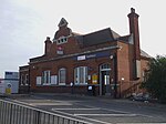
Ponders End

Ponders End is the southeasternmost part of Enfield, north London, centred on the Hertford Road. Situated to the west of the River Lee Navigation, it became industrialised through the 19th century, similar to the Lea Valley in neighbouring Edmonton and Brimsdown, with manufacturing giving way to warehousing in the late-20th century. The area consists heavily of social housing, with streets also lined with 19th and early-20th century suburban terraced housing. As a result of increased levels of immigration, the area has become the most ethnically diverse part of Enfield, with the majority of the population now belonging to an ethnic minority background as first recorded in the 2011 census. The area is undergoing large-scale regeneration, with the high-rise Alma Road Estate currently undergoing demolition and redevelopment by Countryside Properties. The population of Ponders End was 15,664 as of 2011.
Excerpt from the Wikipedia article Ponders End (License: CC BY-SA 3.0, Authors, Images).Ponders End
Stonehorse Road, London Ponders End (London Borough of Enfield)
Geographical coordinates (GPS) Address Website Nearby Places Show on map
Geographical coordinates (GPS)
| Latitude | Longitude |
|---|---|
| N 51.646 ° | E -0.046 ° |
Address
National Tyres & Autocare
Stonehorse Road
EN3 4DY London, Ponders End (London Borough of Enfield)
England, United Kingdom
Open on Google Maps


