place

Island Pond (Rockingham County, New Hampshire)

Lakes of New HampshireLakes of Rockingham County, New HampshireNew Hampshire geography stubs
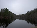
Island Pond, Derry NH

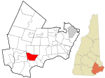
Island Pond (sometimes referred to locally as Big Island Pond) is a 532-acre (215 ha) water body located in Rockingham County in southern New Hampshire, in the towns of Derry, Hampstead and Atkinson. The pond is at the head of the Spicket River watershed, which feeds into the Merrimack River in Lawrence, Massachusetts. The pond was formed from the merger of Perch Pond in Hampstead and Lake Wentworth in Derry in 1878, when a new dam raised the water level by 8.5 feet (2.6 m).The pond is named for Governor's Island, a 231-acre (90 ha) island that lies within it. The island in turn is named for Benning Wentworth, colonial governor of New Hampshire, who built a summer residence on the north end of the island called Birch Farm. A smaller island is named after the Native American chief Escumbuit.The lake is classified as a cold and warmwater fishery and contains largemouth and smallmouth bass, brook trout, rainbow trout, brown trout, chain pickerel, horned pout, white perch, black crappie, and bluegill.

Excerpt from the Wikipedia article Island Pond (Rockingham County, New Hampshire) (License: CC BY-SA 3.0, Authors, Images).

Island Pond (Rockingham County, New Hampshire)
Weston Street,

Geographical coordinates (GPS) Address Nearby Places
placeShow on map

Wikipedia: Island Pond (Rockingham County, New Hampshire)Continue reading on Wikipedia

Geographical coordinates (GPS)

Latitude Longitude
N 42.8675 ° E -71.213333333333 °
placeShow on map

Address

Weston Street 18
03038
New Hampshire, United States
mapOpen on Google Maps

Island Pond, Derry NH
Share experience

Nearby Places

America's Stonehenge

America's Stonehenge is a privately owned tourist attraction and archaeological site consisting of a number of large rocks and stone structures scattered around roughly 30 acres (12 hectares) within the town of Salem, New Hampshire, in the United States. It is open to the public for a fee as part of a recreational area which includes snowshoe trails and an alpaca farm. A number of hypotheses exist as to the origin and purpose of the structures. One viewpoint is a mixture of land-use practices of local farmers in the 18th and 19th centuries and construction of structures by owner William Goodwin, an insurance executive who purchased the area in 1937. Some claim that the site has a pre-Columbian European origin, but this is regarded as pseudoarchaeological. Archaeologist David Starbuck has said: "It is widely believed that Goodwin may have 'created' much of what is visible at the site today.": 106 The site was first dubbed Mystery Hill by William Goodwin. This was the official name of the site until 1982, when it was renamed "America's Stonehenge", a term coined in a news article in the early 1960s. The rebranding was an effort to separate it from roadside oddity sites and to reinforce the idea that it is an ancient archaeological site. The area is named after Stonehenge in England, although there is no evidence of cultural or historical connection between the two. It is mentioned, as Mystery Hill, on New Hampshire Historical Marker No. 72.