place

Upper Rissington

AC with 0 elementsCotswold DistrictUse British English from March 2015Villages in Gloucestershire
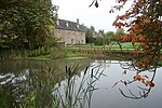
Older housing at Upper Rissington geograph.org.uk 308981

Upper Rissington is a village and civil parish in the Cotswold district of Gloucestershire, England. It is located about two-and-a-half miles east of Bourton-on-the-Water and is one of the highest villages in the Cotswolds at an elevation of 275 m. The village is on the former site of the Central Flying School and the airfield is still the active RAF site of RAF Little Rissington. According to the Gloucestershire Mid-2004 Ward and Parish Population Estimates it had a population of 994. According to the Local Insight Profile it had a population of 1040 in 2014 but this has since grown rapidly due to the new housing. The village is one of the youngest and most dynamic communities in the Cotswolds with 30% of the population under 18 Once famed for its social life in the old ballroom when it housed hundreds of young trainee pilots, the new village is now well known locally for community events such as its firework displays.

Excerpt from the Wikipedia article Upper Rissington (License: CC BY-SA 3.0, Authors, Images).

Upper Rissington
Sopwith Road, Cotswold District Upper Rissington

Geographical coordinates (GPS) Address Nearby Places
placeShow on map

Wikipedia: Upper RissingtonContinue reading on Wikipedia

Geographical coordinates (GPS)

Latitude Longitude
N 51.8764 ° E -1.70507 °
placeShow on map

Address

Sopwith Road

Sopwith Road
GL54 2NL Cotswold District, Upper Rissington
England, United Kingdom
mapOpen on Google Maps

Older housing at Upper Rissington geograph.org.uk 308981
Share experience

Nearby Places

RAF Little Rissington

RAF Little Rissington (ICAO: EGVL) is an RAF aerodrome and RAF station in Gloucestershire, England. It was once home to the Central Flying School, the Vintage Pair and the Red Arrows. Built during the 1930s, the station was opened in 1938 and closed in 1994. The married-quarters and main technical site were sold in 1996 (the former becoming the village of Upper Rissington). RAF Little Rissington has been retained by the Ministry of Defence and is known as Little Rissington Airfield. It remains active along with the southern technical sites, under the operational control of HQ No. 2 Flying Training School RAF at RAF Syerston. It is now home to 621 Volunteer Gliding Squadron RAF and 637 Volunteer Gliding Squadron RAF as the primary military units, providing elementary flying training for Combined Cadet Force and Air Training Corps cadets. The airfield is also used by the forces as a relief landing ground, training area and parachute dropping area. In previous years, the Royal Air Force estate has been used as a film set, including The Avengers, part of the ice chase in Die Another Day, and the Thunderbirds film. In March 2015 a new hangar is being built on the airfield. In 2017 investment was made in upgrading facilities for the RAF Air Cadets. The old fire station was upgraded to provide modern teaching facilities and an accommodation block with canteen was built next door. The new hangar is now operational for the storage and maintenance of the gliders. The airfield has had major groundworks on the grassed area creating a grassed runway.

Salmonsbury Meadows SSSI

Salmonsbury Meadows (grid reference SP178213) is an 18-hectare (44-acre) biological and geological Site of Special Scientific Interest in Gloucestershire, notified in 1985. The site is listed in the 'Cotswold District' Local Plan 2001-2011 (on line) as a Key Wildlife Site (KWS).The site is owned and managed by the Gloucestershire Wildlife Trust, and is part of its Greystones Farm nature reserve (grid reference SP173209). The reserves lie to the east of Bourton-on-the-Water, which is in the Cotswolds. The site, which includes the Site of Special Scientific Interest (SSSI), was bought in three phases over four years. Salmonsbury Meadows were purchased first in 1999. This was followed in 2000 by the Restoration area, which is a 15.9-hectare (39-acre) area of improved grassland adjacent to the SSSI. The third part acquired in 2002 secured the whole farm. This final acquisition included Salmonsbury Camp (ramparts are visible), which is a Scheduled Ancient Monument. The nature reserve is a 66-hectare (160-acre) site. The River Eye runs through the meadows and the River Dikler forms the eastern boundary. There is a network of public footpaths and the long-distance Oxfordshire Way crosses the farm.There is fuller history of Greystones Farm, its meadows and Salmonsbury Camp in a publication produced by the Gloucestershire Wildlife Trust. Further information may be found on the Dobunni, a Celtic tribe which inhabited this area (Iron Age period).