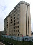
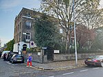
North End, Fulham

North End was, until the last quarter of the 19th-century, a scattered hamlet among the fields and market gardens, between Counter's Creek and Walham Green in the Parish of Fulham in the County of Middlesex.In connection with the development of the Kensington Canal on the northern boundary of Fulham parish, Sir John Scott Lillie built the 'North End Brewery' complex in 1832. The attached public house was called the 'Lillie Arms' (today's Lillie Langtry in Lillie Road) and had a frontage of 140 feet along the newly laid out road running from Lillie Bridge (Fulham) to North End Lane. According to Féret the landlady was a Miss Goslin. All that remains of North End in memory is the North End Road, Fulham. In the 1880s, the area became known as West Kensington. West Kensington tube station on the Metropolitan District Railway, was originally called 'Fulham - North End'.
Excerpt from the Wikipedia article North End, Fulham (License: CC BY-SA 3.0, Authors, Images).North End, Fulham
Talgarth Road, London West Kensington (London Borough of Hammersmith and Fulham)
Geographical coordinates (GPS) Address Nearby Places Show on map
Geographical coordinates (GPS)
| Latitude | Longitude |
|---|---|
| N 51.490833333333 ° | E -0.20694444444444 ° |
Address
Talgarth Road 1-7
W14 9DB London, West Kensington (London Borough of Hammersmith and Fulham)
England, United Kingdom
Open on Google Maps


