place

HMS Raleigh (shore establishment)

Military of the United Kingdom in CornwallMilitary training establishments of the United KingdomRoyal Navy bases in EnglandRoyal Navy shore establishmentsTraining establishments of the Royal Navy
Use British English from April 2016World War II sites in England
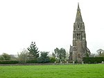
HMS Raleigh from the West geograph.org.uk 373877

HMS Raleigh is a stone frigate (shore establishment), serving as the basic training facility of the Royal Navy at Torpoint, Cornwall, United Kingdom. It is spread over several square miles, and has damage control simulators and fire-fighting training facilities, as well as a permanently moored training ship, the former HMS Brecon. Its principal function is the delivery of both New Entry Training and Basic Training.

Excerpt from the Wikipedia article HMS Raleigh (shore establishment) (License: CC BY-SA 3.0, Authors, Images).

HMS Raleigh (shore establishment)
Cedar Drive,

Geographical coordinates (GPS) Address Nearby Places
placeShow on map

Wikipedia: HMS Raleigh (shore establishment)Continue reading on Wikipedia

Geographical coordinates (GPS)

Latitude Longitude
N 50.3739 ° E -4.2227 °
placeShow on map

Address

HMS Raleigh

Cedar Drive
PL11 2QQ , Torpoint
England, United Kingdom
mapOpen on Google Maps

HMS Raleigh from the West geograph.org.uk 373877
Share experience

Nearby Places

Insworke
Insworke

Insworke is a hamlet in the parish of Millbrook (before 1869 in the parish of Maker) in southeast Cornwall, England, UK. A fair and annual market were held here from 1319.Antiquary William Hals wrote: In this parish or manor, as I take it, stands Intsworh, alias Inis-worth, synonymous words signifying an island of worth, price, or value, viz. a peninsular formed by rivers of water, which leaves between them an angled or three-cornered promontory of land, called in British inis, signifying the same as amnicus mediamnis in Latin. This place, before the Norman Conquest, was the land of Condura and Cradock, Earls of Cornwall, by one of whose daughters or granddaughters, Agnes, it came by marriage to Reginald Fitz-Harry, base son of King Henry I. by Anne Corbet; who, in her right, long after William Earl of Cornwall, of the Norman race, forfeited the same to the King by attainder of treason, was made Earl thereof, from whose heirs it passed to the Dunstanvills and Valletorts; and by Valletort's daughter Joan, the widow of Sir Alexander Oakston, Knt. who turned concubine to Richard Earl of Cornwall, King of the Romans, who had by her a sole daughter named Joan, married to Richard Champernowne, a second son of Sir Champernowne, of Clift Champernowne, in Devon, in whose posterity it remained till Henry VII.'s days, when, his issue male failing, his three daughters and heirs were married to Monk, Fortescue, and Trevillian, from some of whose heirs it came by purchase to Edward Nosworthy, Esquire, Member of Parliament for Saltash, son of Edward Nosworthy, merchant and shopkeeper in Truro, temp. Charles II. who married Hill of that place, as his son aforesaid did Maynard and Jennings.

Churchtown Farm
Churchtown Farm

Churchtown Farm is a community nature reserve one mile south of Saltash, Cornwall, England. It is leased from Antony Estate and managed by Cornwall Wildlife Trust, and includes diverse habitats such as grassland, estuarine mudflats, wetland, woodland, disused quarries and hedgerows.Situated within the Tamar Valley AONB, and positioned between the rivers Tamar and Lynher as well as Forder Creek, the majority of the reserve is farmland. This includes hay meadows and arable fields. At 61 hectares, it is the third biggest reserve that the Cornwall Wildlife Trust owns. The land on the reserve is being farmed in a way which reflects traditional Cornish farming, benefiting wildlife in many ways. Historically, Churchtown Farm was farmed for dairy and arable production. From the 1960s, most of the fields were intensively managed, being re-seeded with highly productive rye grass mixtures maintained by regular applications of chemical fertilisers and heavy grazing. This intensive management has artificially increased the soil nutrients and encouraged pastures with a very limited range of plant species and little structural variation. In such a field there is little insect, animal or bird life. In an attempt to encourage wildlife back to the farm, Cornwall Wildlife Trust are using a number of less intensive management techniques aimed at reducing the soil nutrient levels and increasing the number of plant species. The two disused quarries in the reserve, Forder and Lowhill, were quarried in the 19th century for roadstone. Lowhill closed in 1915. Hornblende-rich dolerite was quarried for use in road construction. Both quarries are now County Geology Sites. Oystercatchers, Dunlins, Egrets, Avocets and Greenshank can all be seen on the mudflats.