Brodhead Creek

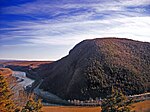
Brodhead Creek is a 21.9-mile-long (35.2 km) tributary of the Delaware River in the Poconos of eastern Pennsylvania in the United States.It is formed by the union of the Middle and Leavitt branches in Barrett Township in Monroe County. The native name was "Analomink." The present name was given for Daniel Brodhead, a prominent early settler. It receives McMichael Creek as it flows south and east into the Delaware River. The stream flows south, separating the boroughs of Stroudsburg and East Stroudsburg. It covers a basin of 294 sq mi and its maximum discharge was 68,800 cubic feet per second, in 1955.Brodhead Creek joins the Delaware River at the head of the Delaware Water Gap.From 1888 to 1944, a coal gasification plant operated at the confluence of Brodhead and McMichael Creeks in Stroudsburg. The operations produced coal tar waste which contaminated the groundwater. The U.S. Environmental Protection Agency (EPA) placed the site on the Superfund National Priorities List in 1983. After cleanup, operations and monitoring activities are ongoing. The EPA removed the site from the National Priorities List in 2001.
Excerpt from the Wikipedia article Brodhead Creek (License: CC BY-SA 3.0, Authors, Images).Brodhead Creek
Cherry Creek Crossing Loop Trail, Smithfield Township
Geographical coordinates (GPS) Address Nearby Places Show on map
Geographical coordinates (GPS)
| Latitude | Longitude |
|---|---|
| N 40.989722222222 ° | E -75.135833333333 ° |
Address
Cherry Creek Crossing Loop Trail
Cherry Creek Crossing Loop Trail
18327 Smithfield Township
Pennsylvania, United States
Open on Google Maps


