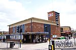
Duckett's Green
Areas of LondonDistricts of the London Borough of HaringeyUse British English from September 2015

Duckett's Green is an area of north London, England in the United Kingdom and part of the London Borough of Haringey. It is an inner-suburban area located 5.8 miles (9.4 km) north of Charing Cross. The area is mainly residential and borders Duckett's Common. Its area is roughly defined by West Green Road to the south-west, Belmont Road to the south-east, Ivatt Way and Langham Road to the north-east, Westbury Avenue to the north and Turnpike Lane Bus Station to the north-west.
Excerpt from the Wikipedia article Duckett's Green (License: CC BY-SA 3.0, Authors, Images).Duckett's Green
Willow Walk, London Harringay (London Borough of Haringey)
Geographical coordinates (GPS) Address Nearby Places Show on map
Geographical coordinates (GPS)
| Latitude | Longitude |
|---|---|
| N 51.589084 ° | E -0.097842 ° |
Address
Willow Walk 59
N15 3DP London, Harringay (London Borough of Haringey)
England, United Kingdom
Open on Google Maps


