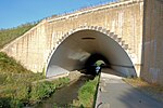
Hollins Green
Geography of WarringtonVillages in Cheshire
Hollins Green is a village on the eastern edge of Warrington, in the Warrington district, in the ceremonial county of Cheshire and formerly in the historic county of Lancashire, England. The village is in the civil parish of Rixton-with-Glazebrook; the ecclesiastical parish is Hollinfare.
Excerpt from the Wikipedia article Hollins Green (License: CC BY-SA 3.0, Authors).Hollins Green
School Lane,
Geographical coordinates (GPS) Address Nearby Places Show on map
Geographical coordinates (GPS)
| Latitude | Longitude |
|---|---|
| N 53.414 ° | E -2.464 ° |
Address
School Lane
School Lane
WA3 6HQ , Rixton-with-Glazebrook
England, United Kingdom
Open on Google Maps


