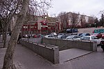
Valverde (Madrid)
Fuencarral-El PardoMadrid geography stubsWards of Madrid

Valverde is an administrative neighborhood (barrio) of Madrid belonging to the district of Fuencarral-El Pardo. It has an area of 8.977802 km2 (3.466349 sq mi). As of 1 March 2020, it has a population of 65,022. The historic centre of Fuencarral (Fuencarral Pueblo), belongs to the Valverde neighborhood. The Hospital Universitario Ramón y Cajal is also located in the neighborhood.
Excerpt from the Wikipedia article Valverde (Madrid) (License: CC BY-SA 3.0, Authors, Images).Valverde (Madrid)
Anillo Verde Ciclista, Madrid Fuencarral (Fuencarral-El Pardo)
Geographical coordinates (GPS) Address Nearby Places Show on map
Geographical coordinates (GPS)
| Latitude | Longitude |
|---|---|
| N 40.505833333333 ° | E -3.6858333333333 ° |
Address
Anillo Verde Ciclista
28049 Madrid, Fuencarral (Fuencarral-El Pardo)
Community of Madrid, Spain
Open on Google Maps


