El Viso (Madrid)

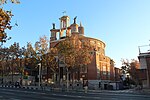
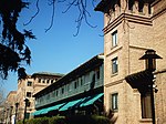
El Viso (Spanish pronunciation: [el ˈbiso]) is a neighborhood of Madrid, part of the Chamartín District. Consisting mainly of residential detached houses, it is currently the wealthiest neighborhood of the Spanish capital, overtaking the Salamanca District. Aristocrats, businessmen, politicians and diplomats have inhabited this area for half a century. The neighborhood also hosts the main headquarters of the Spanish National Research Council (CSIC).It features a roughly rectangular shape, limited by the Paseo de la Castellana, the Avenida de Concha Espina, the Calle del Príncipe de Vergara and the Calle de María de Molina. It has an area of 1.708046 km2 (0.659480 sq mi). As of 1 March 2020, it has a population of 17,502 .
Excerpt from the Wikipedia article El Viso (Madrid) (License: CC BY-SA 3.0, Authors, Images).El Viso (Madrid)
Calle del Maestro Ripoll, Madrid Chamartín
Geographical coordinates (GPS) Address Nearby Places Show on map
Geographical coordinates (GPS)
| Latitude | Longitude |
|---|---|
| N 40.4444 ° | E -3.6888 ° |
Address
Calle del Maestro Ripoll
Calle del Maestro Ripoll
28000 Madrid, Chamartín
Community of Madrid, Spain
Open on Google Maps


