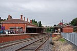
Mount Alexander Shire

The Mount Alexander Shire (officially Shire of Mount Alexander) is a local government area in Victoria, Australia, located in the central part of the state. It covers an area of 1,530 square kilometres (590 sq mi) and, in August 2021, had a population of 20,253. It includes the towns of Castlemaine, Chewton, Elphinstone, Maldon, Newstead, Harcourt, Taradale, Vaughan, Fryerstown and Campbells Creek. It was formed in 1995 from the amalgamation of the City of Castlemaine, Shire of Newstead, and most of the Shire of Maldon and Shire of Metcalfe. The traditional owners of the land are Dja Dja Wurrung.The Shire is governed and administered by the Mount Alexander Shire Council; its seat of local government and administrative centre is located at the council headquarters in Castlemaine, it also has service centres located in Maldon and Newstead. The Shire is named after the first European settlers' name for the Castlemaine region and goldfields.
Excerpt from the Wikipedia article Mount Alexander Shire (License: CC BY-SA 3.0, Authors, Images).Mount Alexander Shire
Barker Street, Shire of Mount Alexander
Geographical coordinates (GPS) Address Nearby Places Show on map
Geographical coordinates (GPS)
| Latitude | Longitude |
|---|---|
| N -37.066666666667 ° | E 144.21666666667 ° |
Address
Barker Street (Midland Highway)
Barker Street
3450 Shire of Mount Alexander
Victoria, Australia
Open on Google Maps


