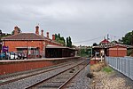
City of Castlemaine
Former local government areas of Victoria (state)Use Australian English from August 2019

The City of Castlemaine was a local government area about 120 kilometres (75 mi) north-northwest of Melbourne, the state capital of Victoria, Australia, and 38 kilometres (24 mi) south of the regional city of Bendigo. The city covered an area of 23.31 square kilometres (9.0 sq mi), and existed from 1855 until 1995.
Excerpt from the Wikipedia article City of Castlemaine (License: CC BY-SA 3.0, Authors, Images).City of Castlemaine
Barker Street, Shire of Mount Alexander
Geographical coordinates (GPS) Address Nearby Places Show on map
Geographical coordinates (GPS)
| Latitude | Longitude |
|---|---|
| N -37.066666666667 ° | E 144.21666666667 ° |
Address
Barker Street (Midland Highway)
Barker Street
3450 Shire of Mount Alexander
Victoria, Australia
Open on Google Maps


