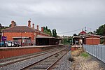
Central Highlands (Victoria)

The Central Highlands subregion is part of the Grampians region in western Victoria. It includes the municipalities of Rural City of Ararat, City of Ballarat, Golden Plains Shire, Shire of Hepburn, Shire of Moorabool, Shire of Pyrenees.The term is mainly used in a geological context to describe that part of the Great Dividing Range that is west of its alpine areas but does not extend to its western end in Victoria's west. The area is situated east of Ballarat, south of Bendigo, north and east of Melbourne, and west of the alpine areas. Major towns of the Central Highlands include Castlemaine, Creswick, Daylesford, Gisborne, Kyneton and Woodend. All these towns are located in what is usually referred to as the West Central Highlands. The more mountainous and more sparsely populated eastern part of the Central Highlands is referred to as the East Central Highlands and has extensive areas of temperate rainforest.
Excerpt from the Wikipedia article Central Highlands (Victoria) (License: CC BY-SA 3.0, Authors, Images).Central Highlands (Victoria)
Wilkie Street, Shire of Mount Alexander
Geographical coordinates (GPS) Address Nearby Places Show on map
Geographical coordinates (GPS)
| Latitude | Longitude |
|---|---|
| N -37.078416666667 ° | E 144.21216666667 ° |
Address
Wilkie Street
Wilkie Street
3450 Shire of Mount Alexander (Campbells Creek)
Victoria, Australia
Open on Google Maps


