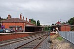
Electoral district of Castlemaine Boroughs
1856 establishments in Australia1859 disestablishments in AustraliaFormer electoral districts of Victoria (state)Victoria (state) government stubs

Castlemaine Boroughs was an electoral district of the Legislative Assembly in the Australian state of Victoria from 1856 to 1859. It included the towns Castlemaine, Muckleford, Harcourt and Elphinstone, all roughly 110 to 130 km north-west of Melbourne. The boundaries included non-continuous urban areas. The district of Castlemaine Boroughs was one of the initial districts of the first Victorian Legislative Assembly, 1856. Castlemaine Boroughs was abolished in 1859, the new district of Castlemaine was created that year when the Victorian Electoral Act of 1858 was implemented.
Excerpt from the Wikipedia article Electoral district of Castlemaine Boroughs (License: CC BY-SA 3.0, Authors, Images).Electoral district of Castlemaine Boroughs
Barker Street, Shire of Mount Alexander
Geographical coordinates (GPS) Address Nearby Places Show on map
Geographical coordinates (GPS)
| Latitude | Longitude |
|---|---|
| N -37.066666666667 ° | E 144.21666666667 ° |
Address
Barker Street (Midland Highway)
Barker Street
3450 Shire of Mount Alexander
Victoria, Australia
Open on Google Maps


