Hobsons Bay
Bays of Victoria (state)Melbourne geography stubsPort PhillipPorts and harbours of Victoria (state)Use Australian English from June 2014

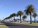
Hobsons Bay is a small open bay in Victoria, Australia, and is the northernmost part of the larger Port Phillip Bay. Its western and eastern boundaries are marked by Point Gellibrand in Williamstown and Point Ormond in Elwood respectively, and defines the coastal margin of the Melbourne suburbs of Wiliamstown, Newport, Port Melbourne, Albert Park, Middle Park, St. Kilda West, St. Kilda and Elwood. The Yarra River flows into Hobsons Bay. Hobsons Bay is named after William Hobson who led the surveying party in Port Philip Bay.
Excerpt from the Wikipedia article Hobsons Bay (License: CC BY-SA 3.0, Authors, Images).Hobsons Bay
Melbourne Port Melbourne
Geographical coordinates (GPS) Address Nearby Places Show on map
Geographical coordinates (GPS)
| Latitude | Longitude |
|---|---|
| N -37.854722222222 ° | E 144.93583333333 ° |
Address
Beacon Cove
3207 Melbourne, Port Melbourne
Victoria, Australia
Open on Google Maps


