place

Hoek van Holland Haven metro station

Railway stations on the Hoekse LijnRailway stations opened in 1893Rotterdam Metro stations located above ground
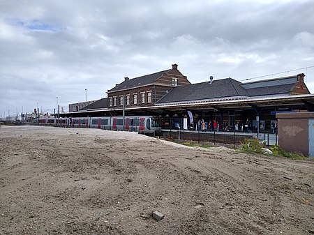
HvHH gebouw
HvHH gebouw

Hoek van Holland Haven (Hook of Holland Harbour) is a metro station on Line B of the Rotterdam Metro, in Hook of Holland (Hoek van Holland), Rotterdam, South Holland. Trains connect with the Stena Line Dutchflyer boat service to Harwich International in England. Until 1 April 2017, it was a railway station served by Nederlandse Spoorwegen. On 30 September 2019, it reopened as the western terminus of RET Metro Line B. Work is underway to extend the line further west to a new Hoek van Holland Strand station and to relocate the platforms to the northwest of their current location along the historical building, so that they are on the new section of the line.

Excerpt from the Wikipedia article Hoek van Holland Haven metro station (License: CC BY-SA 3.0, Authors, Images).

Hoek van Holland Haven metro station
Pastoor Onderwaterhof, Rotterdam

Geographical coordinates (GPS) Address Nearby Places
placeShow on map

Wikipedia: Hoek van Holland Haven metro stationContinue reading on Wikipedia

Geographical coordinates (GPS)

Latitude Longitude
N 51.978055555556 ° E 4.1283333333333 °
placeShow on map

Address

Pastoor Onderwaterhof 5
3151 GT Rotterdam
South Holland, Netherlands
mapOpen on Google Maps

HvHH gebouw
HvHH gebouw
Share experience

Nearby Places

Hook of Holland
Hook of Holland

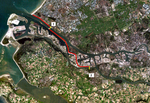
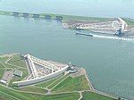
Hook of Holland (Dutch: Hoek van Holland, pronounced [ˈɦuk fɑn ˈɦɔlɑnt] (listen)) is a town in the southwestern corner of Holland, hence the name; hoek means "corner" and was the word in use before the word kaap – "cape", from Portuguese cabo – became Dutch. The English translation using Hook is a false cognate of the Dutch Hoek, but has become commonplace (in official government records in English, the name tends not to get translated and Hoek van Holland is used). It is located at the mouth of the New Waterway shipping canal into the North Sea. The town is administered by the municipality of Rotterdam as a district of that city. Its district covers an area of 16.7 km2, of which 13.92 km2 is land. On 1 January 1999 it had an estimated population of 9,400. Towns near "the Hook" (Dutch: "de Hoek") include Monster, 's-Gravenzande, Naaldwijk and Delft to the northeast, and Maassluis to the southeast. On the other side of the river is the Europort and the Maasvlakte. The wide sandy beach, one section of which is designated for use by naturists, runs for approximately 18 kilometres to Scheveningen and for most of this distance is backed by extensive sand dunes through which there are foot and cycle paths. On the north side of the New Waterway, to the west of the town, is a pier, part of which is accessible to pedestrians and cyclists. The Berghaven is a small harbour on the New Waterway where the Rotterdam and Europort pilots are based. This small harbour is only for the use of the pilot service, government vessels and the Hook of Holland lifeboat.