place

Monster, South Holland

Former municipalities of South HollandMunicipalities of the Netherlands disestablished in 2004Populated places in South HollandWestland (municipality), Netherlands
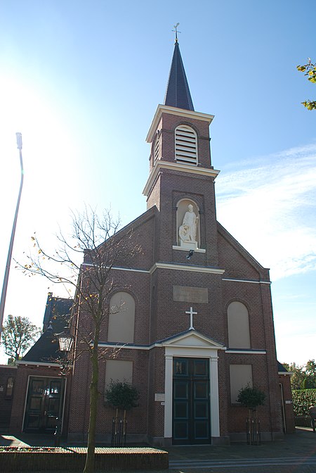
Machuteskerk Monster 1

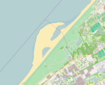
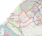
Monster is a town in the Dutch province of South Holland. It is a part of the municipality of Westland, and lies about 10 km (6.2 mi) south-west of The Hague. The village of Monster has a population of around 11,580. The statistical area Monster, which also can include the surrounding countryside, has a population of around 14,540.Until 2004 it was a separate municipality and covered an area of 20.15 km2 (7.78 sq mi) (of which 5.70 km2 (2.20 sq mi) is water). The former municipality of Monster also included the towns, Poeldijk and Ter Heijde. Monster and Ter Heijde are towns on the North Sea coast and have a popular beach.

Excerpt from the Wikipedia article Monster, South Holland (License: CC BY-SA 3.0, Authors, Images).

Monster, South Holland
Larixlaan, Westland

Geographical coordinates (GPS) Address Nearby Places
placeShow on map

Wikipedia: Monster, South HollandContinue reading on Wikipedia

Geographical coordinates (GPS)

Latitude Longitude
N 52.025 ° E 4.1722222222222 °
placeShow on map

Address

Larixlaan 19
2681 EA Westland
South Holland, Netherlands
mapOpen on Google Maps

Machuteskerk Monster 1
Share experience

Nearby Places

Ockenburg

During May 10 to May 12, 1940, Ockenburg, a small Dutch auxiliary airfield near The Hague, was the scene of bitter fighting between German airborne forces and Dutch defenders during World War II. A German formation of one airborne company of Fallschirmjaeger Regiment 2 and a battalion of Air landing troops of IR.65 (22.ID) was envisaged to take the small Air Force Base (AFB) by surprise attack. The strike was part of the grand strategy to seize the Dutch city of the Hague, where the Dutch Royal Family, Cabinet and Military headquarters were situated. The German battle-plan incorporated large combined airborne and airlanding elements to land at the large Dutch AFB's at Valkenburg (South Holland) and Ypenburg and a smaller party at Ockenburg. These three AFB's were situated east, south and west of the Hague. Around 8,000 Germans were scheduled to land and march onto the Hague, snatching the Dutch Royal Family and beheading the Dutch military by capturing their command-centres. The German air-operation against the Hague failed utterly. At Ypenburg AFB the German airborne battalion and follow-up air landing units initially gained some successes, but they were rapidly pushed into defence. Many were captured or killed. Some hundreds managed to sustain Dutch counter-attacks isolating themselves in the hamlet Overschie. At Valkenburg the Germans first managed to seize the airfield running the Dutch defenders off. But after re-grouping the Dutch countered the German pocket and pushed the about 1,000 men strong German presence into a tight defence in the village Valkenburg itself. The Dutch wouldn't manage to force the surviving Germans into surrender though. The landing at Ockenburg too resulted in initial German seizure of the AFB during which 25 Dutch defenders were KIA. But within short the German landing party - no more than around 400 men - were driven off of the pitch and pushed into the dune area between the AFB and the North Sea. In a daring attempt to break out during the following days, the German force (led by the commander of 22.ID, Lieutenant General Hans Graf von Sponeck himself) managed to outmanoeuvre quite substantial Dutch formations and eventually reach the German held pocket at the hamlet Overschie. At that position a combined remnant force of around 1,000 German invaders managed to hold out until being relieved by German ground-forces in the evening of May 14, 1940, after the Rotterdam Blitz.
Hook of Holland
Hook of Holland

Hook of Holland (Dutch: Hoek van Holland, pronounced [ˈɦuk fɑn ˈɦɔlɑnt] (listen)) is a town in the southwestern corner of Holland, hence the name; hoek means "corner" and was the word in use before the word kaap – "cape", from Portuguese cabo – became Dutch. The English translation using Hook is a false cognate of the Dutch Hoek, but has become commonplace (in official government records in English, the name tends not to get translated and Hoek van Holland is used). It is located at the mouth of the New Waterway shipping canal into the North Sea. The town is administered by the municipality of Rotterdam as a district of that city. Its district covers an area of 16.7 km2, of which 13.92 km2 is land. On 1 January 1999 it had an estimated population of 9,400. Towns near "the Hook" (Dutch: "de Hoek") include Monster, 's-Gravenzande, Naaldwijk and Delft to the northeast, and Maassluis to the southeast. On the other side of the river is the Europort and the Maasvlakte. The wide sandy beach, one section of which is designated for use by naturists, runs for approximately 18 kilometres to Scheveningen and for most of this distance is backed by extensive sand dunes through which there are foot and cycle paths. On the north side of the New Waterway, to the west of the town, is a pier, part of which is accessible to pedestrians and cyclists. The Berghaven is a small harbour on the New Waterway where the Rotterdam and Europort pilots are based. This small harbour is only for the use of the pilot service, government vessels and the Hook of Holland lifeboat.