Langone Park

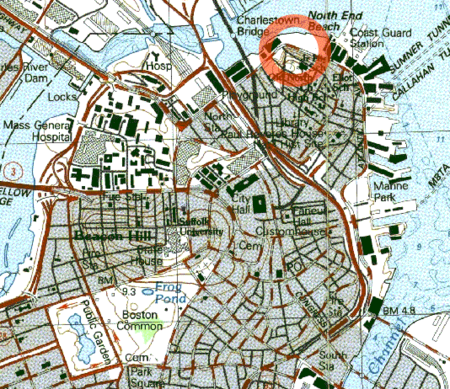
Langone Park is a waterfront park in the North End of Boston, Massachusetts. Established in 1973, it is named for Massachusetts state senator Joseph A. Langone, Jr. and his wife Clementina Langone. The park features a Little League Baseball field, a playground, and three bocce courts. It is located on Commercial Street at the edge of Boston Harbor, immediately to the west of the Andrew P. Puopolo Jr. Athletic Field.The first park at the location, North End Beach (later North End Park), was established in 1893 as a public bathing facility.The park includes much of the area inundated by the 1919 Great Molasses Flood.To the southwest the park borders Copp's Hill Terrace and further south is Copp's Hill Burial Ground. Both sites are listed on the National Register of Historic Places. In October of 2019, the third secret box was discovered by Jason Krupat, the host of an exploration show Josh Gates, and three construction workers.
Excerpt from the Wikipedia article Langone Park (License: CC BY-SA 3.0, Authors, Images).Langone Park
Boston HarborWalk North End, Boston North End
Geographical coordinates (GPS) Address Nearby Places Show on map
Geographical coordinates (GPS)
| Latitude | Longitude |
|---|---|
| N 42.3686 ° | E -71.0559 ° |
Address
Boston HarborWalk North End
Boston HarborWalk North End
02113 Boston, North End
Massachusetts, United States
Open on Google Maps


