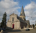
Berendries
Climbs in cycle racing in BelgiumMountains and hills of East FlandersTour of Flanders

The Berendries is an uphill street in Michelbeke, part of the municipality of Brakel, in the Belgian province of East Flanders. Its top is at 98 m altitude, making it the highest hill of the Zwalm region, just north of the Flemish Ardennes. The road has an asphalt surface and links the valley town of Michelbeke to the hilltop town of Sint-Maria-Oudenhove.
Excerpt from the Wikipedia article Berendries (License: CC BY-SA 3.0, Authors, Images).Berendries
Berendries, Brakel
Geographical coordinates (GPS) Address Nearby Places Show on map
Geographical coordinates (GPS)
| Latitude | Longitude |
|---|---|
| N 50.8336 ° | E 3.7747 ° |
Address
De Stappers Alm
Berendries
9660 Brakel
East Flanders, Belgium
Open on Google Maps


