place

Marikina River Park

Buildings and structures in MarikinaParks in Metro ManilaRedeveloped ports and waterfronts in the Philippines
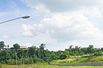
Marikina Riverbanks, Zonta Club (Marikina; 02 21 2022)

The Marikina River Park is a system of parks, trails, open spaces and recreation facilities along an 11-kilometer (6.8 mi) stretch of the Marikina River in Marikina, eastern Metro Manila, Philippines. The urban riverside park covers an area of 220 hectares (540 acres) running through the villages of Santo Niño, Santa Elena, Jesus de la Peña, San Roque, Calumpang, Barangka and Industrial Valley Complex in the western part of the city. The park, under development since 1993, is the city's biggest recreational and sports area containing the Riverbanks Center, a mall and office complex, and the biggest roller skating rink in the Philippines. It is a popular area for camping, jogging, biking and other outdoor activities not just for Marikina residents but also for those from nearby cities in Metro Manila.

Excerpt from the Wikipedia article Marikina River Park (License: CC BY-SA 3.0, Authors, Images).

Marikina River Park
Marikina Calumpang

Geographical coordinates (GPS) Address Nearby Places
placeShow on map

Wikipedia: Marikina River ParkContinue reading on Wikipedia

Geographical coordinates (GPS)

Latitude Longitude
N 14.629722222222 ° E 121.08416666667 °
placeShow on map

Address


1801 Marikina, Calumpang
Philippines
mapOpen on Google Maps

Marikina Riverbanks, Zonta Club (Marikina; 02 21 2022)
Share experience

Nearby Places

Marcos Bridge
Marcos Bridge

The Marcos Bridge is a road bridge that connects the Barangays of Calumpang and Barangka in Marikina in Metro Manila, Philippines The bridge is part of the Marcos Highway (Marikina–Infanta Highway). It consists of an inner bridge and an outer bridge. The outer bridge was constructed in 2008 with the construction of the SM City Marikina which also doubled as an access road to and from the mall. The length of the inner bridge from its two abutments is 341.65 meters (1,120.9 ft), while the outer bridge is at 426.21 m (1,398.3 ft). The outer bridge have 2 westbound lanes in total and a junction at the Calumpang side of the bridge connects to the nearby Macapagal Bridge. A separate but unconnected rail bridge of the Manila Light Rail Transit System's Line 2 line exists parallel to the road bridge. The rail bridge that runs beside the road bridge was constructed by the Hanjin-Itochu Consortium and has a length of 363.39 meters (1,192.2 ft) and a width of 9.4 meters (31 ft). According to a December 2013 report by JICA, the Marcos Bridge has a high traffic volume of Jeepneys, with 6 thousand vehicles crossing the bridge daily.On April 30, 2019, the Metropolitan Manila Development Authority announced the rehabilitation of the Marcos Bridge. The rehabilitation started on May 25, 2019, resulting in closure of the eastbound section that was first rehabilitated, followed by the westbound section four months later. The rehabilitation was finished on October 31, 2019, and the bridge was fully reopened on the same day. The bridge can now withstand a magnitude 7.2 earthquake.