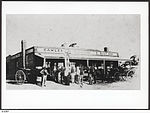
Ward Belt, South Australia
Towns in South AustraliaUse Australian English from August 2019
Ward Belt (originally known as Ward's Belt) is a locality to the west of Gawler in South Australia. The area was NOT named after James Ward and his wife, who arrived in South Australia in the Olivia in 1853. The area is predominantly used for grain, beef and sheep farming. When the Max Fatchen Expressway was completed in 2011, it divided Buchfelde so the portion north of the expressway was reassigned to Ward Belt. This included the area of the Gawler Aerodrome which was formerly in Buchfelde but is now in Ward Belt.
Excerpt from the Wikipedia article Ward Belt, South Australia (License: CC BY-SA 3.0, Authors).Ward Belt, South Australia
Parkers Road, Light Regional Council
Geographical coordinates (GPS) Address Nearby Places Show on map
Geographical coordinates (GPS)
| Latitude | Longitude |
|---|---|
| N -34.58 ° | E 138.67 ° |
Address
Parkers Road
Parkers Road
5118 Light Regional Council
South Australia, Australia
Open on Google Maps


