place

Schelluinen

Former municipalities of South HollandMolenlandenPages with Dutch IPAPopulated places in South HollandSouth Holland geography stubs
Map NL Giessenlanden Schelluinen

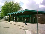
Schelluinen (Dutch pronunciation: [sxɛˈlœynə(n)]) is a village in the Dutch province of South Holland. It is a part of the municipality of Molenlanden, and lies about 4 km west of Gorinchem. In 2017, the village of Schelluinen had 1,426 inhabitants. The built-up area of the village was 0.23 km², and contained 342 residences. The statistical area "Schelluinen", which can include the peripheral parts of the village, as well as the surrounding countryside, has a population of around 1240. Schelluinen was a separate municipality between 1817 and 1986, when it became part of Giessenlanden, which in 2019 merged into Molenlanden.

Excerpt from the Wikipedia article Schelluinen (License: CC BY-SA 3.0, Authors, Images).

Schelluinen
Doctor van Linden Tolstraat, Molenlanden

Geographical coordinates (GPS) Address Nearby Places
placeShow on map

Wikipedia: SchelluinenContinue reading on Wikipedia

Geographical coordinates (GPS)

Latitude Longitude
N 51.8425 ° E 4.9258333333333 °
placeShow on map

Address

Doctor van Linden Tolstraat 10
4209 AL Molenlanden
South Holland, Netherlands
mapOpen on Google Maps

Map NL Giessenlanden Schelluinen
Share experience

Nearby Places

Hoornaar
Hoornaar

Hoornaar is a town in the Dutch province of South Holland, in the Alblasserwaard, north of the river Merwede and south of the river Lek. It is a part of the municipality of Molenlanden, and lies about 5 km north of Gorinchem. In 2007, the town of Hoornaar had 1655 inhabitants. The built-up area of the town was 0.24 km². The statistical area "Hoornaar", which also can include the peripheral parts of the village, as well as the surrounding countryside, has a population of around 1580.Hoornaar was a separate municipality between 1817 and 1986, when it became part of Giessenlanden.The town hall of the municipality Giessenlanden lies within the town's borders. The small rivers Kromme Giessen, Giessen and Kleine Vaart flow through the town. The name Hoornaar is derived from Hornedamme. A 'Horne' is a curve in a river. Years ago the river Linge joined the river Giessen behind the village of Hoogblokland. There a dam was built and a settlement originated. Because of the existence of so-called donken, which are hills of sand made by glacial sedimentation, and the lack of them elsewhere, it is known that Hoornaar has a long history. The history of Hoornaar is quiet. There was a raid on the village in 1481. In the 11th century an attack of Gofried of Lotharingen was prohibited by count Dirk III of Holland. In the 19th century Hoornaar became depended on the harvest of cannabis for its fibers to make rope with. Later on Hoornaar became more depended on potato and beet harvest. Besides stockbreeding, cheese trade and export companies became important to the village economy.