place

Annacis Island

Delta, British ColumbiaIslands of the Fraser River
GVRD Annacis island
GVRD Annacis island

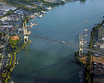
Annacis Island is a narrow island under the jurisdiction of City of Delta in Lower Mainland, British Columbia, located just downstream of the south arm of the Fraser River bifurcation between Lulu Island to the north and the Delta peninsula to the south. The island is now mostly an industrial zone, and contains one of Metro Vancouver's secondary wastewater treatment plants, the Annacis Island Wastewater Treatment Plant. The island is also home to the British Columbia Institute of Technology's Annacis Island campus.The southern part of the island is connected to Delta via the Alex Fraser Bridge, which is part of Highway 91. Connections northward to Richmond and New Westminster are via smaller bridges on Highway 91. At the eastern end of the island there is also the Annacis Island Swing Bridge which connects the island to the Queensborough neighborhood of New Westminster on the eastern end of Lulu Island. Annacis Island is served by a public bus that connects to 22nd Street Station in New Westminster. The wider part of the Fraser River south of the island is known as Annieville Channel (upstream) and City Reach (downstream), while the more narrow channel north of the island is Annacis Channel. The eastern (upstream) tip of the island is known as Shoal Point, and the western (downstream) tip as Purfleet Point.

Excerpt from the Wikipedia article Annacis Island (License: CC BY-SA 3.0, Authors, Images).

Annacis Island
Derwent Way, Delta

Geographical coordinates (GPS) Address Website Nearby Places
placeShow on map

Wikipedia: Annacis IslandContinue reading on Wikipedia

Geographical coordinates (GPS)

Latitude Longitude
N 49.166666666667 ° E -122.94972222222 °
placeShow on map

Address

Annacis Island Wastewater Treatment Plant

Derwent Way 1299
V3M 5V9 Delta
British Columbia, Canada
mapOpen on Google Maps

Website
metrovancouver.org

linkVisit website

GVRD Annacis island
GVRD Annacis island
Share experience

Nearby Places

Alex Fraser Bridge
Alex Fraser Bridge

The Alex Fraser Bridge (also known as the Annacis Bridge) is a cable-stayed bridge over the Fraser River that connects Richmond and New Westminster with North Delta in Greater Vancouver, British Columbia. The bridge is named for Alex Fraser (1916 – 1989), a former British Columbia Minister of Transportation. The bridge was the longest cable-stayed bridge in the world when it opened on September 22, 1986, and was the longest in North America until the Arthur Ravenel Jr. Bridge, in the U.S. state of South Carolina opened in 2005. H==Overview== The Alex Fraser Bridge is 2,525 m (8,284 ft) long with a main span of 465 m (1,526 ft). The towers are 154 m (505 ft) tall. It consists of seven lanes, three in each direction with the middle lane acting as a counterflow lane, and had a maximum speed limit of 90 km per hour until July 24, 2019 when the speed limit was lowered to 70 km/h to accommodate the additional counterflow lane. Upon opening in 1986, only four of the six available lanes were open. Cyclists and pedestrians share two narrow sidewalks one on each side. All six lanes opened in 1987 after traffic demand justified the need.The bridge's southern end is in North Delta and its northern end is on Delta's Annacis Island. Connections on its southern end lead to Blaine, Washington and to White Rock. The connections on the northern end lead into the cities of New Westminster, Richmond, and Burnaby, and on into Vancouver itself. It is a major artery in the Lower Mainland of British Columbia. The bridge was constructed for the British Columbia Ministry of Transportation and was designed by a joint venture of Klohn Crippen Berger and Buckland & Taylor (Now COWI North America). Its total cost was $58 million.

CNR Bridge
CNR Bridge

Opened in 1931, the Canadian National Railway (CNR) steel truss swing span railway bridge over the north arm of the Fraser River in Metro Vancouver links Burnaby with Richmond and the south arm Vancouver Fraser Port Authority facilities on Lulu Island. The Canadian Northern Railway (CNoR) had planned to lay track from the north end of the New Westminster Bridge and cross the Fraser at the 1931 location. However, when the CNoR opened the Lulu Island branch line in 1917, it connected with the British Columbia Electric Railway (BCER) Queensborough terminus. Since the original BCER Queensborough bridge was designed for trams, not heavy locomotives, the CNoR westward route 12.02 miles (19.34 km) to Stevestona was an isolated branch line. After the CNR absorption of the bankrupt CNoR, the money-losing branch, and damage to trestles from a 1918 muskeg fire at Mile 4, terminated all services. In July 1930, work began on sinking piers for the 4,200-foot-long bridge with a 240-foot central span. On completion in November 1931, work trains carried the steel rails across the bridge to lay 14 miles (23 km) of track for the Lulu Island industrial branch line. This comprised two north–south lines from west of the new bridge to connect with the remnants of the original east–west line at the south arm, with a scheduled completion date for the $2m project before yearend.Owing to the proximity of several bridges on the Fraser, the unique signal for the opening of the Lulu Island Bridge was four long blasts on the vessel's horn.In 2013, CN removed the observer-operators from three movable span bridges in the Lower Mainland comprising the Second Narrows, New Westminster and Lulu Island bridges, and now monitors river traffic by camera from a central location.^a . The former BCER "Y" at today's Branscombe Court.