place

Baboosic Lake

Lakes of Hillsborough County, New HampshireNew Hampshire geography stubs
Lake Baboosic public beach and dock

Baboosic Lake (buh-BOO-sik) is a 228.5-acre (92.5 ha) lake on the border of the towns of Amherst and Merrimack, in New Hampshire. The lake drains into Baboosic Brook, a tributary of the Merrimack River. Baboosic is a "warm water lake" and supports fish species such as chain pickerel, largemouth bass, yellow perch, catfish, and many sunfish. During winter months the lake freezes and is suitable for ice fishing, ice skating and snowmobiling. Baboosic was once a popular destination for vacationers who traveled via the historical Boston & Maine Railroad Manchester & Milford branch train. Camp Young Judaea, a Jewish summer camp for children ages 8–15, is on the lake.

Excerpt from the Wikipedia article Baboosic Lake (License: CC BY-SA 3.0, Authors, Images).

Baboosic Lake
Lakeside Drive,

Geographical coordinates (GPS) Address Nearby Places
placeShow on map

Wikipedia: Baboosic LakeContinue reading on Wikipedia

Geographical coordinates (GPS)

Latitude Longitude
N 42.883888888889 ° E -71.577222222222 °
placeShow on map

Address

Lakeside Drive

Lakeside Drive
03054
New Hampshire, United States
mapOpen on Google Maps

Lake Baboosic public beach and dock
Share experience

Nearby Places

Amherst Village Historic District

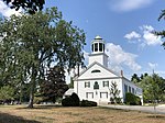
The Amherst Village Historic District encompasses the historic village center of Amherst, New Hampshire. Centered on the town's common, which was established about 1755, Amherst Village is one of the best examples of a late-18th to early-19th century New England village center. It is roughly bounded on the north by Foundry Street and on the south by Amherst Street, although it extends along some roads beyond both. The western boundary is roughly Davis Lane, the eastern is Mack Hill Road, Old Manchester Road, and Court House Road. The district includes the Congregational Church, built c. 1771-74, and is predominantly residential, with a large number of Georgian, Federal, and Greek Revival houses. Other notable non-residential buildings include the Farmer's Bank, a Federal-style brick building built in 1806, and the Amherst Brick School, a brick Greek Revival structure that has served as the School Administrative Unit 39 offices since 1997.Amherst was surveyed in 1735, and settled by veterans of King Philip's War from Massachusetts. Its first colonial meeting house was built in 1749 on a hill northeast of the village common, and was moved to the common after the town was incorporated in 1760. Several houses, including one originally used as a tavern, that were built in its immediate area in 1750 are still standing. Amherst was the first shire town of Hillsborough County (organized 1769), and was located roughly midway between Boston, Massachusetts and Lake Champlain, and it flourished economically. The present town hall was built in 1825 as the county's third courthouse. The town entered a decline when the people began leaving for more fertile lands in the American Midwest, and when the town was bypassed by significant industrialization. In 1862, the county functions were moved to the growing industrial centers of Nashua and Manchester.The district was listed on the National Register of Historic Places in 1982. The Hildreth-Jones Tavern, located at 18 Jones Road, was added to the New Hampshire State Register of Historic Places on January 26, 2004.

New Boston Space Force Station

New Boston Space Force Station (BOSS) is a United States Space Force facility located in Hillsborough County in south central New Hampshire. It was transferred from the United States Air Force to the Space Force in the summer of 2020.The installation occupies more than 2,800 acres (11 km2) in three towns: New Boston, Amherst, and Mont Vernon. It was originally established in 1942 as a practice area for bombers and fighter planes from nearby Grenier Army Air Field (now Manchester–Boston Regional Airport). Starting in 1959, it was turned into a satellite-tracking station, providing the facility's most prominent feature, the weatherproof radomes which dot the hillside. BOSS has been providing support for northernly launches from KSC/Cape Canaveral for decades, and has supported the Shuttle and Titan IV programs. Since 2020 the facility has also provided line of sight telemetry tracking for commercial space launches by SpaceX.New Boston SFS is operated by the 23rd Space Operations Squadron (23 SOPS), a geographically separated unit (GSU) of Space Delta 6, part of Space Base Delta 1 at Schriever Space Force Base, Colorado. The 23rd SOPS operates and maintains the largest Satellite Control Network remote tracking station at New Boston SFS, as well as at three other GSU's located at Thule Air Base, Greenland, RAF Oakhanger, United Kingdom, and the Eastern Vehicle Checkout Facility located at Cape Canaveral, Florida. The squadron provides real-time capability to users performing on-orbit tracking, telemetry, commanding and mission data retrieval services. Additionally, the squadron provides remote command and control capability through two Global Positioning System Control stations located at Cape Canaveral and Ascension Island in the South Atlantic Ocean. The squadron also operates and maintains a Defense Satellite Communications System Heavy Earth Terminal, and additional equipment in support of the National Oceanographic Atmospheric Administration and other mission partners. The installation and infrastructure are said to be worth more than $106 million.