Deas Island

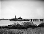
Deas Island is a peninsula in the south arm of the Fraser River between Delta, British Columbia and Richmond, British Columbia, Canada. It is home to a regional park approximately 300 acres (120 ha) in size; and has three historic buildings: Burrvilla, a stately Victorian home; Inverholme, a one-room schoolhouse; and the Delta Agricultural Hall. Between 1895-1940's, the peninsula had a small Greek settlement with a population of about 80 at its peak.It is s habitat for many kinds of birds, and a popular bird-watching destination. The peninsula is notable as the site of the southern end of the George Massey Tunnel (originally the Deas Island Tunnel), which is part of Highway 99 and connects Delta to Richmond. The tunnel goes from Deas Island to Lulu Island (Richmond) to the north. A small bridge completes the connection between Deas Island and the main part of Delta.
Excerpt from the Wikipedia article Deas Island (License: CC BY-SA 3.0, Authors, Images).Deas Island
Deas Island Road, Delta
Geographical coordinates (GPS) Address Nearby Places Show on map
Geographical coordinates (GPS)
| Latitude | Longitude |
|---|---|
| N 49.121 ° | E -123.065 ° |
Address
Deas Island Road
Deas Island Road
V4K 5E3 Delta
British Columbia, Canada
Open on Google Maps


