George Massey Tunnel

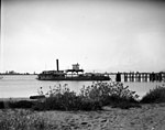
The George Massey Tunnel (often referred to as the Massey Tunnel) is a highway traffic tunnel in the Metro Vancouver region of southwestern British Columbia. It is located approximately 20 km (12.4 mi) south of the city centre of Vancouver, British Columbia, and approximately 30 km (18.6 mi) north of the Canada–United States border at Blaine, Washington. Construction, costing approximately $16.6 million in 1959 ($140 million in 2017), began on the tunnel in March 1957, and it was opened to traffic on May 23, 1959 as the Deas Island Tunnel. Queen Elizabeth II attended the official opening ceremony of the tunnel on July 15, 1959. It carries a four-lane divided highway under the south arm of the Fraser River estuary, joining the City of Richmond to the north with the City of Delta to the south. It is the only road tunnel below sea level in Canada, making its roadway the lowest road surface in Canada. The Massey Tunnel was the first to use immersed tube technology in British Columbia.The tunnel forms part of Highway 99. It is named for Nehamiah "George" Massey, a former Member of the Legislative Assembly of British Columbia. He represented Delta between 1956 and 1960, and was a long-time advocate of a permanent crossing to replace the Ladner Ferry that crossed the south arm of the Fraser River. The tunnel was renamed the George Massey Tunnel in 1967, three years after Massey died. It is still sometimes referred to by its previous name, the Deas Island Tunnel. Dangerous goods are not allowed to pass through the tunnel.
Excerpt from the Wikipedia article George Massey Tunnel (License: CC BY-SA 3.0, Authors, Images).George Massey Tunnel
George Massey Tunnel, Delta
Geographical coordinates (GPS) Address External links Nearby Places Show on map
Geographical coordinates (GPS)
| Latitude | Longitude |
|---|---|
| N 49.121663 ° | E -123.075628 ° |
Address
George Massey Tunnel
George Massey Tunnel
V4K 0C9 Delta (Shellmont)
British Columbia, Canada
Open on Google Maps


