Perth Amboy is a city in Middlesex County, in the U.S. state of New Jersey. Perth Amboy is part of the New York metropolitan area. As of the 2020 United States census, the city's population was 55,436, an increase of 4,622 (+9.1%) from the 2010 census count of 50,814, which in turn reflected an increase of 3,511 (+7.4%) from the 47,303 counted in the 2000 census. Perth Amboy has a Hispanic majority population. In the 2010 census, the Hispanic population made up 78.1% of the population, the second-highest in the state, behind Union City at 84.7%. Perth Amboy is known as the "City by the Bay", referring to its location adjoining Raritan Bay. The Census Bureau's Population Estimates Program calculated that the city's population was 55,357 in 2021, ranking the city as the 725th-most-populous in the country.The earliest residents of the area were the Lenape Native Americans, who called the point on which the city lies "Ompoge". Perth Amboy was settled in 1683 by Scottish colonists and was called "New Perth" after James Drummond, 4th Earl of Perth; the native name was eventually corrupted and the two names were merged. Perth Amboy was formed by Royal charter in 1718, and the New Jersey Legislature reaffirmed its status in 1784, after independence. The city was a capital of the Province of New Jersey from 1686 to 1776. During the mid-1800s, the Industrial Revolution and immigration grew the city, developing a variety of neighborhoods which residents from a diverse range of ethnicities lived in. The city developed into a resort town for the Raritan Bayshore near it, but the city has grown in other industries since its redevelopment starting in the 1990s.
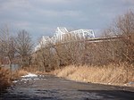
Perth Amboy borders the Arthur Kill and features a historic waterfront. The Perth Amboy Ferry Slip was once an important ferry slip on the route south from New York City; it was added to the National Register of Historic Places in 1978. The Raritan Yacht Club, one of the oldest yacht clubs in the United States, is located in the city. Perth Amboy is connected to the Staten Island borough of New York City via the Outerbridge Crossing.


