place

Jegou's Island

Burlington, New JerseyIslands of the Delaware RiverLandforms of Burlington County, New JerseyRiver islands of New Jersey

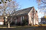
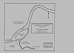
Jegou's Island or Chygoe's Island is a former island located at the junction of Assiscunk Creek and the Delaware River, on which the central portion of the city of Burlington, in Burlington County, New Jersey, is located. The Moat, a now partially filled distributary of Assiscunk Creek, formerly separated the island from the mainland.

Excerpt from the Wikipedia article Jegou's Island (License: CC BY-SA 3.0, Authors).

Jegou's Island
East Pearl Street,

Geographical coordinates (GPS) Address Nearby Places
placeShow on map

Wikipedia: Jegou's IslandContinue reading on Wikipedia

Geographical coordinates (GPS)

Latitude Longitude
N 40.0817 ° E -74.8499 °
placeShow on map

Address

East Pearl Street

East Pearl Street
08016
New Jersey, United States
mapOpen on Google Maps

Share experience

Nearby Places

City of Burlington Public School District

The City of Burlington Public School District is a comprehensive community public school district that serves students in pre-Kindergarten through twelfth grade in the City of Burlington, in Burlington County, New Jersey, United States. The district is one of 31 former Abbott districts statewide that were established pursuant to the decision by the New Jersey Supreme Court in Abbott v. Burke which are now referred to as "SDA Districts" based on the requirement for the state to cover all costs for school building and renovation projects in these districts under the supervision of the New Jersey Schools Development Authority. As of the 2020–21 school year, the district, comprised of four schools, had an enrollment of 1,740 students and 170.9 classroom teachers (on an FTE basis), for a student–teacher ratio of 10.2:1.The district is classified by the New Jersey Department of Education as being in District Factor Group "B", the second lowest of eight groupings. District Factor Groups organize districts statewide to allow comparison by common socioeconomic characteristics of the local districts. From lowest socioeconomic status to highest, the categories are A, B, CD, DE, FG, GH, I and J.The district's high school serves as a receiving school for students in grade nine through twelve from Edgewater Park Township, as part of a sending/receiving relationship with the Edgewater Park School District.

Assiscunk Creek

Assiscunk Creek is a tributary of the Delaware River in southwestern New Jersey in the United States.The name Assiscunk (also spelled Assiscunke or Essiscunk) came from the Lenape language meaning "muddy creek". Other names were Wissahisk River, Birch Creek, and Barracks Creek. Assiscunk Creek is approximately 17-mile (27 km) long, and drains an area of approximately 60 square miles (160 km2) of Burlington County, New Jersey. It originates in Springfield Township, and soon forms the border between Springfield Township and Mansfield Township. It is fed by Annaricken Brook, and then by Crafts Creek just at the U.S. Route 206 crossing. Assiscunk Branch and Barkers Brook enter between U.S. Route 206 and the New Jersey Turnpike crossing. The creek begins to widen on the outskirts of Burlington City, where it empties into the Delaware River. Wetlands along the creek are habitats for many species, among them the bog turtle, which is considered a threatened and endangered species. The creek is designated as suboptimal under Habitat Analysis, and has moderately impaired waters, a major improvement from recent decades when the river was designated as severely impaired or having marginal habitat conditions.Pollution is a problem for the Assiscunk Creek, and much of this comes from non-point sources. The land around the creek is mostly agricultural, but there are areas of urban surfaces and forest as well. Assiscunk Creek is still an impaired river, but has improved greatly in recent years thanks to hard efforts to stop the pollution.