place

St. Mary's Episcopal Church, Burlington, New Jersey

18th-century Episcopal church buildings19th-century Episcopal church buildingsAnglican cemeteries in the United StatesBurlington, New JerseyCemeteries in Burlington County, New Jersey
Cemeteries on the National Register of Historic Places in New JerseyChurches completed in 1703Churches completed in 1854Churches on the National Register of Historic Places in New JerseyEpiscopal church buildings in New JerseyGothic Revival church buildings in New JerseyNRHP infobox with nocatNational Historic Landmarks in New JerseyNational Register of Historic Places in Burlington County, New JerseyUse mdy dates from August 2023
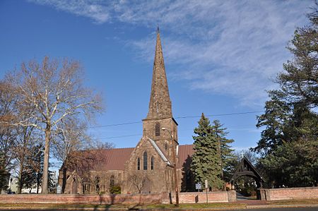
BurlingtonNJ NewStMarysChurch 02

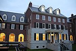
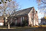
St. Mary's Episcopal Church is a historic Episcopal parish in Burlington, Burlington County, New Jersey, United States. The original church was built in 1703. It was supplemented with a new church on adjacent land in 1854. On May 31, 1972, the new church was added to the National Register of Historic Places and on June 24, 1986, it was declared a National Historic Landmark. It is within the Burlington Historic District.

Excerpt from the Wikipedia article St. Mary's Episcopal Church, Burlington, New Jersey (License: CC BY-SA 3.0, Authors, Images).

St. Mary's Episcopal Church, Burlington, New Jersey
West Broad Street,

Geographical coordinates (GPS) Address Nearby Places
placeShow on map

Wikipedia: St. Mary's Episcopal Church, Burlington, New JerseyContinue reading on Wikipedia

Geographical coordinates (GPS)

Latitude Longitude
N 40.076944444444 ° E -74.861944444444 °
placeShow on map

Address

West Broad Street 172
08016
New Jersey, United States
mapOpen on Google Maps

BurlingtonNJ NewStMarysChurch 02
Share experience

Nearby Places

City of Burlington Public School District

The City of Burlington Public School District is a comprehensive community public school district that serves students in pre-Kindergarten through twelfth grade in the City of Burlington, in Burlington County, New Jersey, United States. The district is one of 31 former Abbott districts statewide that were established pursuant to the decision by the New Jersey Supreme Court in Abbott v. Burke which are now referred to as "SDA Districts" based on the requirement for the state to cover all costs for school building and renovation projects in these districts under the supervision of the New Jersey Schools Development Authority. As of the 2020–21 school year, the district, comprised of four schools, had an enrollment of 1,740 students and 170.9 classroom teachers (on an FTE basis), for a student–teacher ratio of 10.2:1.The district is classified by the New Jersey Department of Education as being in District Factor Group "B", the second lowest of eight groupings. District Factor Groups organize districts statewide to allow comparison by common socioeconomic characteristics of the local districts. From lowest socioeconomic status to highest, the categories are A, B, CD, DE, FG, GH, I and J.The district's high school serves as a receiving school for students in grade nine through twelve from Edgewater Park Township, as part of a sending/receiving relationship with the Edgewater Park School District.

Burlington–Bristol Bridge

The Burlington–Bristol Bridge is a truss bridge with a lift span crossing the Delaware River from Burlington, New Jersey to Bristol Township, Pennsylvania in the United States. Construction of the bridge started on April 1, 1930, and the bridge opened to traffic on May 2, 1931. The bridge carries New Jersey Route 413 and Pennsylvania Route 413 (PA 413). The two-lane bridge has a total length of 2,301 feet (701 m), and is operated by the Burlington County Bridge Commission. The lift span is 540 feet (164.6 m) long.The center span is lifted by the action of two large concrete slabs of slightly greater weight than the lifted span, which block traffic when fully down. They are set in downwards motion to lift the bridge by a very slight action of the motors, as gravity does the rest. In 2016, traffic signals and barrier gates were installed at each end of the bridge for stopping traffic when the draw span is being lifted. A municipal garage is located underneath the rising road after the tollbooths. During times when the bridge is up for a boat passing underneath, large traffic backups are created on Keim Boulevard, the road that functions as the route to the bridge from U.S. Route 130 (US 130) and Broad Street. The tollbooths are equipped with E-ZPass and the toll as of September 15, 2015 — $4.00 for cars, or $3 with E-ZPass — is paid by vehicles crossing into Pennsylvania.New bridges for the site have been proposed, but most would require the access ramp to extend out to US 130, which would result in the destruction of historic buildings, as well as the large industrial park near the bridge.