Gravesham

Gravesham ( GRAYV-shəm) is a local government district with borough status in north-west Kent, England. Its administrative centre and largest town is Gravesend, which was known as Gravesham in ancient times. Gravesham was formed on 1 April 1974 by the merger of the Municipal Borough of Gravesend with Northfleet Urban District and part of Strood Rural District, under the Local Government Act 1972. It borders the Borough of Dartford and Sevenoaks District to the west, the Borough of Tonbridge and Malling to the south, the Medway unitary authority to the east and the Thurrock unitary authority of Essex to the north, via the River Thames. Gravesham is twinned with Cambrai in Hauts-de-France, France and Neumünster in Schleswig-Holstein, Germany. The present borders of Gravesham parliamentary constituency are almost the same as those of the borough.
Excerpt from the Wikipedia article Gravesham (License: CC BY-SA 3.0, Authors, Images).Gravesham
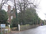
Watling Street, Gravesham Shorne
Geographical coordinates (GPS) Address Nearby Places Show on map
Geographical coordinates (GPS)
| Latitude | Longitude |
|---|---|
| N 51.409 ° | E 0.399 ° |
Address
Watling Street
Watling Street
DA12 3HB Gravesham, Shorne
England, United Kingdom
Open on Google Maps


