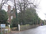
Cobham, Kent
Civil parishes in KentGraveshamVillages in Kent

Cobham () is a village and civil parish in the borough of Gravesham in Kent, England. The village is located 6 miles (10 km) south-east of Gravesend, and just south of Watling Street, the Roman road from Dover to London. The parish, which includes the hamlet of Sole Street, covers an area of 1,240 hectares (3,100 acres) and had a population of 1,469 at the 2011 Census, increasing from 1,328 at the 2001 Census. Since 1970 the village has been in a conservation area which aims to preserve the historic character and appearance of the area.
Excerpt from the Wikipedia article Cobham, Kent (License: CC BY-SA 3.0, Authors, Images).Cobham, Kent
Lawrence Drive, Gravesham Cobham
Geographical coordinates (GPS) Address Nearby Places Show on map
Geographical coordinates (GPS)
| Latitude | Longitude |
|---|---|
| N 51.3898 ° | E 0.4008 ° |
Address
Lawrence Drive
Lawrence Drive
DA12 3BU Gravesham, Cobham
England, United Kingdom
Open on Google Maps


