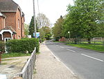
Harting
Chichester DistrictNapoleonic beacons in EnglandVillages in West Sussex

Harting is a civil parish in the Chichester District of West Sussex, England. It is situated on the northern flank of the South Downs, around 3.5 miles (5.6 km) southeast of Petersfield in Hampshire. It comprises the village of South Harting and the hamlets of East Harting, West Harting and Nyewood. The area of the parish is 3,216 hectares (7,950 acres). At the 2011 Census, the population was 1,451, an increase from 1,407 at the 2001 Census.
Excerpt from the Wikipedia article Harting (License: CC BY-SA 3.0, Authors, Images).Harting
Chichester Harting
Geographical coordinates (GPS) Address Nearby Places Show on map
Geographical coordinates (GPS)
| Latitude | Longitude |
|---|---|
| N 50.97 ° | E -0.88 ° |
Address
GU31 5PU Chichester, Harting
England, United Kingdom
Open on Google Maps


