South Harting
Villages in West Sussex

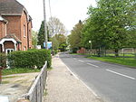
South Harting is a village within Harting civil parish in the Chichester district of West Sussex, England. It lies on the B2146 road, 4 miles (6.4 km) southeast of Petersfield in Hampshire. South Harting has two churches, one Anglican and one Congregational, plus a school and a pub. The National Trust property Uppark sits high on the South Downs, 1 mile (1.6 km) south of the village on the B2146.
Excerpt from the Wikipedia article South Harting (License: CC BY-SA 3.0, Authors, Images).South Harting
B2146, Chichester Harting
Geographical coordinates (GPS) Address Nearby Places Show on map
Geographical coordinates (GPS)
| Latitude | Longitude |
|---|---|
| N 50.96983 ° | E -0.88263 ° |
Address
B2146
GU31 5QA Chichester, Harting
England, United Kingdom
Open on Google Maps


