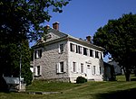
Catasauqua Creek

Catasauqua Creek is an ENE–SSW oriented creek draining 6.6 miles (10.6 km) (straight line distance) from springs of the Blue Mountain barrier ridge several miles below the Lehigh Gap in the Ridge-and-Valley Appalachians located upriver and opposite from Allentown in Lehigh and Northampton counties in the Lehigh Valley region of eastern Pennsylvania. The mouth of the creek outlets directly opposite West Catasauqua just below Race Street bridge across the Lehigh River, the latest of the several successor structures built to replace the original wooden bridge built in 1839-1840 to carry heavy wagons of iron ore to the new furnaces being built within the new village aborning as the Lehigh Crane Iron Company created the infrastructure to father the iron and steel industry of the Lehigh Valley. The head of the Creek begins in the Dannersville neighborhood of Bath at 40°44′16″N latitude 75°25′58″W longitude (or 40.737849,-75.432824), forming a steep sided ravine almost immediately as it gathers waters over its first mile. As it passes Sauerkraut Hill, it gathers two major tributary creeks and leaves a steeper terrain for a gentler run over the last four miles.
Excerpt from the Wikipedia article Catasauqua Creek (License: CC BY-SA 3.0, Authors, Images).Catasauqua Creek
D&L Trail,
Geographical coordinates (GPS) Address Nearby Places Show on map
Geographical coordinates (GPS)
| Latitude | Longitude |
|---|---|
| N 40.647011 ° | E -75.468957 ° |
Address
D&L Trail
D&L Trail
18032
Pennsylvania, United States
Open on Google Maps


