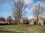
Hobrede
Geography of Edam-VolendamNorth Holland geography stubsPages with non-numeric formatnum argumentsPopulated places in North Holland

Hobrede is a village in the Dutch province of North Holland. It is a part of the municipality of Edam-Volendam, and lies about 4 km northeast of Purmerend. The village was first mentioned in 1639 as Hobreet, and means the main side of the parcel of lands which connect the dike. The width of the land determined the maintenance fee of the farmer for the dike.Hobrede used to have a church, but it was demolished in 1826. In 1840, it was home to 115 people. In 1991, the inhabitants of Hobrede built their own village house.
Excerpt from the Wikipedia article Hobrede (License: CC BY-SA 3.0, Authors, Images).Hobrede
Oud-Raeffeldamweg, Edam-Volendam
Geographical coordinates (GPS) Address Nearby Places Show on map
Geographical coordinates (GPS)
| Latitude | Longitude |
|---|---|
| N 52.545 ° | E 4.9808333333333 ° |
Address
Oud-Raeffeldamweg 2
1477 EG Edam-Volendam
North Holland, Netherlands
Open on Google Maps


