place

Turf Valley, Maryland

Howard County, Maryland geography stubsUnincorporated communities in Howard County, MarylandUnincorporated communities in MarylandUse mdy dates from July 2023

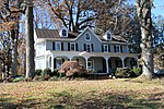
Turf Valley is an unincorporated community in Ellicott City, Maryland, United States. The resort is situated in a wedge between Route 70 and U.S. Route 40, with the David Force Natural Resource Area along the northern border. Construction contractor Samuel M Pistorio (1902-1998) purchased 1000 acres of farmland west of Ellicott City. He introduced the $1 million Turf Valley Country Club in 1958. The 1500 person club featured two 18-hole golf courses designed by Ault and Jaminson. The Clubhouse opened in December 1959.Turf Valley proposed falling under the "New Town" zoning proposed in 1965 or the creation of the Rouse Company development Columbia. Amendments were placed in the New Town Zoning increasing the minimum required acreage owned by a project from 750 to 2500 acres, effectively removing Turf Valley from immediate competition to the project.The Resort later was purchased by Nicholas B. Mangione of Mangione Enterprises. In 1979, Mangione in combination with the Gudelski family company Percontee, planner William P. Brendle and attorney Bernard F. Goldberg petitioned to rezone the 646 acre project from three-acre lots to half-acre lots claiming 50 acres would be open space. The property was redeveloped for housing units alongside the golf course with sewer service approved in 1989. In 1985, the Catholic Archdioceses sold Donald R. Reuwer Jr. the graveyard of St. Mary's Church for $10,000. In 1991, H. Allen Becker developed Turf Valley Overlook housing development on a 3.5 acre St. Mary's Church parcel that contained Doughoregan Manor worker graves. Protesters requested Charles I. Ecker purchase the land for open space, but the development and clearing were allowed to proceed.

Excerpt from the Wikipedia article Turf Valley, Maryland (License: CC BY-SA 3.0, Authors).

Turf Valley, Maryland
Marriottsville Road,

Geographical coordinates (GPS) Address Nearby Places
placeShow on map

Wikipedia: Turf Valley, MarylandContinue reading on Wikipedia

Geographical coordinates (GPS)

Latitude Longitude
N 39.295277777778 ° E -76.891111111111 °
placeShow on map

Address

Turf Valley

Marriottsville Road
21104
Maryland, United States
mapOpen on Google Maps

Share experience

Nearby Places

Waverly (Marriottsville, Maryland)

Waverly Mansion is a historic home located at Marriottsville in Howard County, Maryland, USA. It was built circa 1756, and is a 2+1⁄2-story Federal style stone house, covered with stucco, with a hyphen and addition that date to circa 1811. Also on the property are a small 1+1⁄2-story stone overseer's cottage and a 2-story frame-and-stone barn, and the ruins of a log slave quarter.Waverly was a property developed on land first patented by Charles Carroll of Carrollton and later part of the 1703 survey "Ranter's Ridge" owned by Captain Thomas Browne. The land was resurveyed in 1726 as "The Mistake." It was purchased by John Dorsey and deeded to his son and daughter-in-law, Nathan and Sophia Dorsey as the next owners.The property is associated with the Dorsey and Howard families. From the time it was established through the end of the Civil War, Waverly functioned as a plantation where unpaid slave labor was used for farm operations and creation of the wealth and lifestyle afforded to the Dorsey and Howard families. Through deeds, census records and an inventory taken upon the death of George Howard in 1846, information about the enslaved population at Waverly was uncovered. A 1965 article in the Ellicott City Times claimed that 999 slaves worked on the plantation at one time, but research has shown that between 7 and 25 enslaved men, women and children is more accurate. The Ellicott City Times article does not have any primary sources to back up this claim, nor is there an author's name credited to the article.

Shipley House

The Shipley House was located in Alpha, Howard County, Maryland, near Marriottsville. The house was among five other buildings supporting a farm in Alpha, Maryland. The 55-acre (22 ha) property was part of a 3,440-acre (1,390 ha) land grant named Woodford patented in 1727. John Taylor acquired the land and 2,707 acres (1,095 ha) of the estate were sold to Phillip Hammond in 1744. In 1777, Charles Hammond bequeathed 1,500 acres (610 ha) of Woodford and his slaves to his son. Nathan Shipley acquired a portion and through inheritance, Joshua H. Shipley acquired 77 acres (31 ha) of the Woodford estate, raising 12 children on-site. The slave plantation harvested tobacco and grain crops. The frame farm house was constructed in 1830. Outbuildings included a wellhouse (1900), a frame shed (1835), and a bank barn (1884). John and Mary O'Mara farmed and maintained the property as Sunnyside Farm, raising hoses and cattle until sale in 1979. The farm was purchased by Howard County in 1979 as possible expansion space for the controversial Alpha Ridge Landfill project. The county boarded up the properties without maintenance. In August 1992, the firm of Goodwin and Associates determined that the deterioration that occurred in twelve years of ownership by Howard County negated any effort to preserve the property. The land was converted to the Alpha Ridge Community Park in 1994, demolishing the Shipley House and outbuildings to replace them with a complex of revenue generating ball fields and facilities.

Burleigh (Ellicott City, Maryland)

Burleigh, also known as Burleigh Manor or Hammonds Inheritance, is a historic home located at Ellicott City, Howard County, Maryland, built on a 2,300-acre (930 ha) estate. Which included "Hammonds Inheritance" patented in 1796. It is a Federal-style brick dwelling built between 1797 and 1810, laid in Flemish bond. Based on the 1798 Tax assessment of the Elkridge Hundred, the original manor house started as a one-story frame building 24 by 18 foot in size. Also on the landscaped grounds are a 1720 stone smokehouse; a much-altered log, stone, and frame "gatehouse" or "cottage," built in 1820 as a workhouse for slaves and another log outbuilding, as well as an early-20th century bathhouse, 1941 swimming pool, and tennis court. Portions of the estate once included the old Annapolis Road which served the property until the construction of Centennial Lane to connect Clarksville to Ellicott City in 1876. The manor was built by Colonel Rezin Hammond (1745–1809), using the same craftsmen as his brother Mathias Hammond's Hammond–Harwood House in Annapolis. Rezin and his brother Matthias were active in the colonial revolution with notable participation in the burning of the Peggy Stewart (ship). Hammond bequeathed the manor and 4,500 acres (1,800 ha) to his grandnephew Denton Hammond (1785–1813) and his wife Sara who lived there until her death in 1832. All slave labor were offered manumission upon Rezin Hammonds death in 1809, with extra provisions for tools, land and livestock for thirty two slaves. The estate was owned by Civil War veteran Colonel Mathias until his death where he was buried alongside other family members on the estate. His wife Clara Stockdale Hammond maintained ownership afterward. In 1914 the estate was owned by Mary Hanson Hammond with land totaling over 1,000 acres (400 ha) including the outbuildings and slave quarters. In 1935 the Estate was subdivided to 600 acres (240 ha) and purchased by Charles McAlpin Pyle, Grandson of industrialist David Hunter McAlpin. The manor house was renovated with the great kitchen replaced by a "Stirrup Room" where meetings of the Howard County Hunt Club were performed. The house was sold in 1941 to Mrs. Anthony J. Drexel Biddle, Jr. for use of Prince Alexandre Hohenlohoe of Poland during WWII. St. Timothy's School bought the property after the war in 1946, but abandoned plans and sold to Mrs G. Dudley Iverson IV in 1950. The brick was once painted yellow, but by 1956, had almost returned to exposed red brick. As of 2013, it has operated as a livestock shelter.In November 1976 the county executive, Edward L. Cochran, commissioned a $35,000 survey by Resource Management Associates Inc. to analyze 600 acres (240 ha) of the manor property for a landfill site at a set contract price of $2,250,000, but a task force recommendation led to a site selection in Marriottsville. In 1979 A historical survey was conducted, listing the owner as Maple Lawn developer Stewart J Greenbaum. In 1982 Burleigh was listed on the National Register of Historic Places. In 1987, the wife of former County Executive Cochran listed Burleigh Manor and 15 surrounding acres for sale for $750,000.