place

Howard County Conservancy

1990 establishments in MarylandHoward County, Maryland landmarksNature centers in MarylandProtected areas of Howard County, MarylandTourist attractions in Howard County, Maryland
HCConserveOutside
HCConserveOutside

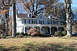
The Howard County Conservancy is a non-profit land trust that operates a nature center in Woodstock, Maryland. It is located at the 300-year-old, 232-acre (0.94 km2) Mt. Pleasant Farm.

Excerpt from the Wikipedia article Howard County Conservancy (License: CC BY-SA 3.0, Authors, Images).

Howard County Conservancy
Old Frederick Road,

Geographical coordinates (GPS) Address Phone number Website External links Nearby Places
placeShow on map

Wikipedia: Howard County ConservancyContinue reading on Wikipedia

Geographical coordinates (GPS)

Latitude Longitude
N 39.315555555556 ° E -76.874166666667 °
placeShow on map

Address

Howard County Conservancy at Mt. Pleasant

Old Frederick Road 10520
21163
Maryland, United States
mapOpen on Google Maps

Phone number

call4104658877

Website
howardnature.org

linkVisit website

linkWikiData (Q5919351)
linkOpenStreetMap (12507362)

HCConserveOutside
HCConserveOutside
Share experience

Nearby Places

Waverly (Marriottsville, Maryland)

Waverly Mansion is a historic home located at Marriottsville in Howard County, Maryland, USA. It was built circa 1756, and is a 2+1⁄2-story Federal style stone house, covered with stucco, with a hyphen and addition that date to circa 1811. Also on the property are a small 1+1⁄2-story stone overseer's cottage and a 2-story frame-and-stone barn, and the ruins of a log slave quarter.Waverly was a property developed on land first patented by Charles Carroll of Carrollton and later part of the 1703 survey "Ranter's Ridge" owned by Captain Thomas Browne. The land was resurveyed in 1726 as "The Mistake." It was purchased by John Dorsey and deeded to his son and daughter-in-law, Nathan and Sophia Dorsey as the next owners.The property is associated with the Dorsey and Howard families. From the time it was established through the end of the Civil War, Waverly functioned as a plantation where unpaid slave labor was used for farm operations and creation of the wealth and lifestyle afforded to the Dorsey and Howard families. Through deeds, census records and an inventory taken upon the death of George Howard in 1846, information about the enslaved population at Waverly was uncovered. A 1965 article in the Ellicott City Times claimed that 999 slaves worked on the plantation at one time, but research has shown that between 7 and 25 enslaved men, women and children is more accurate. The Ellicott City Times article does not have any primary sources to back up this claim, nor is there an author's name credited to the article.

Turf Valley, Maryland

Turf Valley is an unincorporated community in Ellicott City, Maryland, United States. The resort is situated in a wedge between Route 70 and U.S. Route 40, with the David Force Natural Resource Area along the northern border. Construction contractor Samuel M Pistorio (1902-1998) purchased 1000 acres of farmland west of Ellicott City. He introduced the $1 million Turf Valley Country Club in 1958. The 1500 person club featured two 18-hole golf courses designed by Ault and Jaminson. The Clubhouse opened in December 1959.Turf Valley proposed falling under the "New Town" zoning proposed in 1965 or the creation of the Rouse Company development Columbia. Amendments were placed in the New Town Zoning increasing the minimum required acreage owned by a project from 750 to 2500 acres, effectively removing Turf Valley from immediate competition to the project.The Resort later was purchased by Nicholas B. Mangione of Mangione Enterprises. In 1979, Mangione in combination with the Gudelski family company Percontee, planner William P. Brendle and attorney Bernard F. Goldberg petitioned to rezone the 646 acre project from three-acre lots to half-acre lots claiming 50 acres would be open space. The property was redeveloped for housing units alongside the golf course with sewer service approved in 1989. In 1985, the Catholic Archdioceses sold Donald R. Reuwer Jr. the graveyard of St. Mary's Church for $10,000. In 1991, H. Allen Becker developed Turf Valley Overlook housing development on a 3.5 acre St. Mary's Church parcel that contained Doughoregan Manor worker graves. Protesters requested Charles I. Ecker purchase the land for open space, but the development and clearing were allowed to proceed.