place

The Narrows

Bodies of water of Staten IslandStraits of Kings County, New YorkStraits of Richmond County, New YorkUse American English from April 2019Use mdy dates from April 2019
Verazzano Narrows Bridge aerial 01 white balanced (9457282678)

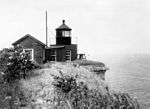
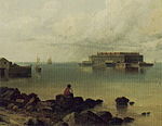
The Narrows is the tidal strait separating the boroughs of Staten Island and Brooklyn in New York City, United States. It connects the Upper New York Bay and Lower New York Bay and forms the principal channel by which the Hudson River empties into the Atlantic Ocean. It has long been considered to be the maritime "gateway" to New York City and historically has been one of the most important entrances into the harbors of the Port of New York and New Jersey.

Excerpt from the Wikipedia article The Narrows (License: CC BY-SA 3.0, Authors, Images).

Geographical coordinates (GPS)

Latitude Longitude
N 40.613333333333 ° E -74.048055555556 °
placeShow on map
Verazzano Narrows Bridge aerial 01 white balanced (9457282678)
Share experience

Nearby Places

Verrazzano-Narrows Bridge

The Verrazzano-Narrows Bridge ( vər-ə-ZAH-noh; also referred to as the Verrazzano Bridge, locally as the Verrazzano, and formerly as the Verrazano-Narrows Bridge or Narrows Bridge) is a suspension bridge connecting the New York City boroughs of Staten Island and Brooklyn. It spans the Narrows, a body of water linking the relatively enclosed New York Harbor with Lower New York Bay and the Atlantic Ocean. It is the only fixed crossing of the Narrows. The double-deck bridge carries 13 lanes of Interstate 278: seven on the upper level and six on the lower level. The span is named for Giovanni da Verrazzano, who in 1524 was the first European explorer to enter New York Harbor and the Hudson River. Engineer David B. Steinman proposed a bridge across the Narrows in the late 1920s, but plans were deferred over the next twenty years. A 1920s attempt to build a Staten Island Tunnel was aborted, as was a 1930s plan for vehicular tubes underneath the Narrows. Discussion of a tunnel resurfaced in the mid-1930s and early 1940s, but the plans were again denied. In the late 1940s, urban planner Robert Moses championed a bridge across the Narrows as a way to connect Staten Island with the rest of the city. Various problems delayed the start of construction until 1959. Designed by Othmar Ammann, Leopold Just, and other engineers at Ammann & Whitney, the bridge opened on November 21, 1964, and a lower deck in 1969 to alleviate high levels of traffic. The New York City government began a $1.5 billion reconstruction of the bridge's two decks in 2014. The Verrazzano-Narrows Bridge has a central span of 4,260 feet (1.30 km; 0.81 mi). It was the longest suspension bridge in the world until it was surpassed by the Humber Bridge in the United Kingdom in 1981. The bridge has the 18th-longest main span in the world, as well as the longest in the Americas. When the bridge was officially named in 1960, it was misspelled "Verrazano-Narrows Bridge" due to an error in the construction contract; the name was officially corrected in 2018. The Verrazzano-Narrows Bridge collects tolls in both directions, although only westbound drivers paid a toll from 1986 to 2020 in an attempt to reduce traffic congestion.

John Paul Jones Park

John Paul Jones Park is a public park located in Fort Hamilton, Bay Ridge, Brooklyn. The park borders Shore Road, Fourth Avenue, 101st Street, and Fort Hamilton Parkway. The park is managed by the New York City Department of Parks and Recreation, which acquired the property from the city of Brooklyn in 1897.John Paul Jones Park is named after the American patriot and naval commander of the same name, who was known for his leadership in the American Revolution. He is often referred to as "the father of the Navy." John Paul Jones Park is home to several memorials from various events in American history: Rodman gun: a massive, black, twenty-inch bore that was created in 1864 by artilleryman Thomas Jackson Rodman. It was originally situated in Fort Pitt, Pennsylvania, but was presented to the park by the United States Military in 1900. Today it dominates the park along with cannon balls that surrounds the landscape and is part of the Civil War Memorial. Revolutionary War Memorial: contains a bronze tablet that is inscribed into a granite boulder. This plaque was granted by the Long Island Society of the Daughters of the American Revolution in 1916 to commemorate the first resistance made to British arms in New York in August 1776. Dover Patrol Naval War Memorial: features a monument that was gifted by Sir Ashton Webb in 1931, from England after World War I. It serves as a dedication to the Dover Patrol for its service and comradeship in the American Naval Force in Europe during the first World War. The monument has a pyramid-shaped copper capstone at the top of the obelisk. In addition to these memorials is a 70 foot tall flag pole that once belonged to a Navy destroyer. It was added to the park in 1980 alongside a plaque that reads "in honor of John Paul Jones, the father of the Navy."