Fort Wadsworth
1663 establishments in the Dutch Empire1994 disestablishments in New York (state)American Civil War fortsAmerican Revolutionary War fortsColonial forts in New York (state) ... and 17 more
Establishments in New NetherlandForts in New York (state)Forts in New York CityGateway National Recreation AreaHistoric American Engineering Record in New York (state)Installations of the United States Army in New York (state)Military and war museums in New York (state)Military history of New York CityMilitary installations closed in 1994Military installations established in the 17th centuryMuseums in Staten IslandNational Register of Historic Places in Staten IslandNeighborhoods in Staten IslandParks in Staten IslandUnited States Coast Guard installationsUse mdy dates from September 2019War of 1812 forts

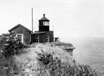
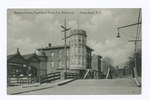
Fort Wadsworth is a former United States military installation on Staten Island in New York City, situated on The Narrows which divide New York Bay into Upper and Lower halves, a natural point for defense of the Upper Bay and Manhattan beyond. Prior to closing in 1994 it claimed to be the longest continually garrisoned military installation in the United States. It comprises several fortifications, including Fort Tompkins and Battery Weed and was given its present name in 1865 to honor Brigadier General James Wadsworth, who had been killed in the Battle of the Wilderness during the Civil War. Fort Wadsworth is now part of the Staten Island Unit of Gateway National Recreation Area, maintained by the National Park Service.
Excerpt from the Wikipedia article Fort Wadsworth (License: CC BY-SA 3.0, Authors, Images).Fort Wadsworth
Geographical coordinates (GPS) Nearby PlacesShow on map
Geographical coordinates (GPS)
| Latitude | Longitude |
|---|---|
| N 40.605 ° | E -74.056666666667 ° |


