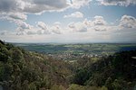
Muckhart
Muckhart (Scottish Gaelic: Muc-Àird) commonly refers to two small villages in Clackmannanshire, Scotland, Pool of Muckhart (Scottish Gaelic: Poll Mhuc-Àird) and Yetts o' Muckhart. Muckhart is one of the Hillfoots Villages, situated on the A91 around 3 miles (5 kilometres) northeast of Dollar. The Gaelic name, Muc-àird, comes from muc ("pig") + àird ("height"), and may derive from the fact that the surrounding fields may once have been used for pig farming. Previously Muckhart, together with Glendevon, formed the southernmost tip of Perthshire. It was transferred to Clackmannanshire in a reorganisation of boundaries in 1971. The parish boundary is somewhat eccentric and extends to the outer edge of Dollar, some three miles (five kilometres) west. Due to this fact, the primary school is somewhat oddly located (the 1876 Act required the school to be at the centre of the parish) and lies over 1⁄2 mile (800 metres) west of the outer edge of the main village. It is also some considerable distance from the main road. This can be explained in that it lies on the old coach road to Dollar. This is now just a dirt track to the school (locally known as the Cinder Path). West of the school the old coach route is very hard to follow. The famed, historic Rumbling Bridge across Rumbling Bridge Gorge of the River Devon in Kinrosshire is about 300 metres (1,000 feet) south of the Muckhart Golf Course on the A823.
Excerpt from the Wikipedia article Muckhart (License: CC BY-SA 3.0, Authors).Muckhart
A91,
Geographical coordinates (GPS) Address Nearby Places Show on map
Geographical coordinates (GPS)
| Latitude | Longitude |
|---|---|
| N 56.18841 ° | E -3.61125 ° |
Address
A91
FK14 7JN
Scotland, United Kingdom
Open on Google Maps


