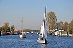
Kaag
Kaag en BraassemPages with non-numeric formatnum argumentsPopulated places in South HollandSouth Holland geography stubs

Kaag is a village in the Dutch province of South Holland. It is a part of the municipality of Kaag en Braassem, and lies about 8 kilometres (5.0 miles) northeast of Leiden. The village of Kaag lies on an island called Kagereiland in the Kager Lakes (Kagerplassen). To reach De Kaag, a ferry can be taken from Buitenkaag all year or Zevenhuizen in the summer months. De Kaag is also part of an area called the Duin- en Bollenstreek ("Dune and Bulb Region"). The village is conventionally referred to as "De Kaag", but the name reported on both English and Dutch maps is just "Kaag".
Excerpt from the Wikipedia article Kaag (License: CC BY-SA 3.0, Authors, Images).Kaag
Hellegatspolder, Teylingen
Geographical coordinates (GPS) Address Nearby Places Show on map
Geographical coordinates (GPS)
| Latitude | Longitude |
|---|---|
| N 52.216666666667 ° | E 4.55 ° |
Address
Hellegatspolder 5
2361 NA Teylingen
South Holland, Netherlands
Open on Google Maps


