place

Front Street Historic District (Weymouth, Massachusetts)

Historic districts in Norfolk County, MassachusettsHistoric districts on the National Register of Historic Places in MassachusettsNRHP infobox with nocatNational Register of Historic Places in Norfolk County, MassachusettsWeymouth, Massachusetts
WeymouthMA CemeteryChapel

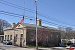
The Front Historic District is a predominantly residential historic district in Weymouth, Massachusetts. From the 18th to the 20th century, the area encompassed by this district was one of the more fashionable and desirable neighborhoods adjacent to the commercial Weymouth Landing area. It also contains remnants of a once-flourishing small scale shoe manufacturing industry. The 77-acre (31 ha) district includes nearly 150 resources, primarily residential houses, as well as a school, two cemeteries, and a small cluster of commercial buildings. The district was added to the National Register of Historic Places in 2011.The district is focused on the northern stretch of Front Street, extending roughly from Washington Street in the north to Congress Street in the south. It also includes rows of properties along Summer Street from its junction with Front Street to Kingman Street, as well as Franklin and Broad Streets; individual properties lie on other streets immediately adjacent to the included sections of Front and Summer Streets.The geographically largest portions of the district are the Weymouth Village Cemetery (established 1843), at its southeastern corner, Weston Park (established in the 1920s) in its northeast, and the Hunt Street School property (a Colonial Revival public school built 1915-17 that now houses a private Christian academy). The oldest building in the district is a Cape Style house built c. 1720 at 160 Front Street; there are other 18th century Cape and Georgian style homes on Front and Summer Streets. One example of a 19th-century shoemaker's shop that survives is the building at 99 Front Street, now converted to a residence. Smaller shops, which have been converted to garages or other outbuildings, also survive at 131 and 204 Front Street.

Excerpt from the Wikipedia article Front Street Historic District (Weymouth, Massachusetts) (License: CC BY-SA 3.0, Authors, Images).

Front Street Historic District (Weymouth, Massachusetts)
Front Street,

Geographical coordinates (GPS) Address Nearby Places
placeShow on map

Wikipedia: Front Street Historic District (Weymouth, Massachusetts)Continue reading on Wikipedia

Geographical coordinates (GPS)

Latitude Longitude
N 42.210833333333 ° E -70.961944444444 °
placeShow on map

Address

Front Street

Front Street
02188
Massachusetts, United States
mapOpen on Google Maps

WeymouthMA CemeteryChapel
Share experience

Nearby Places

Fore River (Massachusetts)

Weymouth Fore River is a small bay or estuary in eastern Massachusetts and is part of the Massachusetts Bay watershed. The headwater of Weymouth Fore River is formed by the confluence of the Monatiquot River and Smelt Brook in the Weymouth Landing area of Braintree. From Weymouth Landing, the tidal river marks the boundary between Braintree and Weymouth, flowing northeast for 0.5 miles (0.80 km) and then north for 0.5 miles (0.80 km) before widening considerably and turning west northwest for 0.7 miles (1.1 km). At this point the river's western shore is now in Quincy at the south end of the former Fore River Shipyard. Here the river turns north northeast for 1.0 mile (1.6 km) as it passes through a heavily industrialized area around the former shipyard and is crossed by the Fore River Bridge, a lift bridge which carries Massachusetts Route 3A between Quincy and Weymouth. A quarter mile beyond the bridge Weymouth Fore River is joined by Town River at Germantown, gradually widening to nearly 1 mile (1.6 km) as it travels the final 2.0 miles (3.2 km) northeast before ending as it enters Hingham Bay. Recreation along Weymouth Fore River includes Smith Beach/Watson Park in East Braintree along the northwest shore near Weymouth Landing at the river's south end and Wessagussett Beach on the southeast shore in North Weymouth before the river enters Hingham Bay. The United States Naval Shipbuilding Museum located in Quincy Point at the west end of the Fore River Bridge features USS Salem, a preserved heavy cruiser which is open to the public. The major commercial enterprises located in the heavily industrialized area around the former shipyard include: Braintree Citgo Petroleum Corporation, major oil and gasoline distribution terminal Quincy Daniel J. Quirk, Inc., motor vehicle storage and distribution facility Jay Cashman, Inc., heavy construction and marine equipment services Massachusetts Water Resources Authority, sewage sludge heat-drying and pelletizing facility Quincy Bay Terminal Company, short line freight rail service to CSXT South Braintree Twin Rivers Technologies LP, oleochemical and biofuel production Weymouth Calpine Fore River Generating Station, natural gas and oil electricity generation