Radnage
Civil parishes in BuckinghamshireVillages in Buckinghamshire

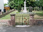
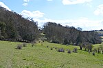
Radnage is a village and civil parish in the Buckinghamshire district of Buckinghamshire, England. It is in the Chiltern Hills about two miles north east of Stokenchurch and six miles WNW of High Wycombe. The parish is set in folds of the Chiltern Hills to the south of Bledlow Ridge next to the border with Oxfordshire. Although not a large parish, the residential areas known as the city, Bennett End and Town End, are separate hamlets. Radnage (also spelled Radeneach, Rodenache etc. in old documents) meant ‘red oak’ in Old English.
Excerpt from the Wikipedia article Radnage (License: CC BY-SA 3.0, Authors, Images).Radnage
Grange Farm Road,
Geographical coordinates (GPS) Address Nearby Places Show on map
Geographical coordinates (GPS)
| Latitude | Longitude |
|---|---|
| N 51.668 ° | E -0.87 ° |
Address
Grange Farm Road
Grange Farm Road
HP14 4EF
England, United Kingdom
Open on Google Maps


