place

Tilbury Riverside railway station

Disused railway stations in EssexFormer London, Tilbury and Southend Railway stationsGrade II* listed buildings in EssexPages with no open date in Infobox stationRailway depots in England
Railway stations in Great Britain closed in 1992Railway stations in Great Britain opened in 1854TilburyTransport in ThurrockUse British English from March 2012
Tilbury riverside railway station postcode

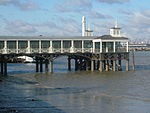
Tilbury Riverside railway station is a closed railway station located in the town of Tilbury in the borough and unitary authority of Thurrock in Essex, England, south of a triangular junction on the railway between Tilbury Town and East Tilbury. The station was 22 miles 46 chains (36.33 km) down the line from London Fenchurch Street station via Rainham.

Excerpt from the Wikipedia article Tilbury Riverside railway station (License: CC BY-SA 3.0, Authors, Images).

Tilbury Riverside railway station
Fort Road, Thurrock

Geographical coordinates (GPS) Address Nearby Places
placeShow on map

Wikipedia: Tilbury Riverside railway stationContinue reading on Wikipedia

Geographical coordinates (GPS)

Latitude Longitude
N 51.4519 ° E 0.3646 °
placeShow on map

Address

Fort Road

Fort Road
RM18 7NJ Thurrock
England, United Kingdom
mapOpen on Google Maps

Tilbury riverside railway station postcode
Share experience

Nearby Places

Tilbury Fort
Tilbury Fort

Tilbury Fort, also known historically as the Thermitage Bulwark and the West Tilbury Blockhouse, is an artillery fort on the north bank of the River Thames in England. The earliest version of the fort, comprising a small blockhouse with artillery covering the river, was constructed by King Henry VIII to protect London against attack from France as part of his Device programme. It was reinforced during the 1588 Spanish Armada invasion scare, after which it was reinforced with earthwork bastion, and Parliamentary forces used it to help secure the capital during the English Civil War of the 1640s. Following naval raids during the Anglo-Dutch Wars, the fort was enlarged by Sir Bernard de Gomme from 1670 onwards to form a star-shaped defensive work, with angular bastions, water-filled moats and two lines of guns facing onto the river. In addition to protecting the Thames, in the 18th century Tilbury also began to be used a transit depot and for storing gunpowder. It continued to be essential for the defence of the capital and a new artillery battery was added in the south-east corner during the Napoleonic Wars. The fort became decreasingly significant as a defensive structure as military technology developed in the 19th century. It was redeveloped to hold heavy artillery after 1868, providing a second line of defence along the river, but further changes in technology meant that it had become obsolete by the end of the century. Instead Tilbury became a strategic depot, forming a logistical hub for storing and moving troops and materiel throughout the First World War. The fort had only a limited role in the Second World War and was demobilised in 1950. Tilbury Fort is now operated by the charity English Heritage Trust as a tourist attraction, receiving 16,154 visitors in 2014. Many of the more modern military features were demolished during the 1950s, with further restoration work taking place during the 1970s ahead of the site opening to the public in 1983. The 17th-century defences are considered by the historian Paul Pattison to be the "best surviving example of their kind in Britain", and the fort includes the only surviving early 18th century gunpowder magazines in Britain.