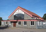
RAF Durrington
Radar networksRoyal Air Force stations in West SussexUse British English from January 2018
RAF Durrington was a World War II ground-controlled interception (GCI) radar station in Durrington, West Sussex, a neighbourhood in Worthing in the United Kingdom. RAF Durrington was one of six radar stations built in coastal areas in 1941 to improve the radar capability of the Royal Air Force during night bombing raids by the Axis powers.
Excerpt from the Wikipedia article RAF Durrington (License: CC BY-SA 3.0, Authors).RAF Durrington
Palatine Road,
Geographical coordinates (GPS) Address Phone number Website Nearby Places Show on map
Geographical coordinates (GPS)
| Latitude | Longitude |
|---|---|
| N 50.8253 ° | E -0.414 ° |
Address
Palatine Primary School
Palatine Road
BN12 6JP , West Worthing
England, United Kingdom
Open on Google Maps


