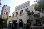
Zobel Roxas Street

Zobel Roxas Street is an east-west street that forms the southeastern limit of the City of Manila, the northwestern city limit of Makati, and the northern city limit of Pasay, all in Metro Manila, Philippines. It stretches across western Metro Manila from F. Muñoz Street in the Singalong area of Malate to Tejeron Street at the district boundary of San Andres Bukid and Santa Ana. It has a short extension northeast of the Tejeron Street–J.P. Rizal Avenue junction as Del Pan Street. Zobel Roxas and other streets in the area (e.g., Alfonso, Consuelo, Enrique, Fernando, Jacobo, Don Pedro, C. Ayala and T. Ayala Streets) were named after members of the Róxas de Ayala and Zóbel de Ayala families, whose company, Ayala y Compañía, developed portions of Singalong and San Andres into residential areas in the 1930s. These areas were part of the vast Hacienda San Pedro de Macati which José Bonifacio Róxas purchased in 1851 and later developed into commercial and residential areas. Zobel Roxas was historically known as Casal Street.
Excerpt from the Wikipedia article Zobel Roxas Street (License: CC BY-SA 3.0, Authors, Images).Zobel Roxas Street
Zobel Roxas Street, Makati
Geographical coordinates (GPS) Address Nearby Places Show on map
Geographical coordinates (GPS)
| Latitude | Longitude |
|---|---|
| N 14.568055555556 ° | E 121.00527777778 ° |
Address
Rafael Palma Elementary School
Zobel Roxas Street
1204 Makati (District I)
Philippines
Open on Google Maps


