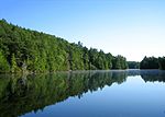
Quinebaug Highlands
Geography of Hampden County, MassachusettsGeography of Tolland County, ConnecticutGeography of Windham County, ConnecticutGeography of Worcester County, MassachusettsHighlands ... and 4 more
Tourist attractions in Hampden County, MassachusettsTourist attractions in Tolland County, ConnecticutTourist attractions in Windham County, ConnecticutTourist attractions in Worcester County, Massachusetts
The Quinebaug Highlands are a 172,000 acre region of mountains surrounding the Connecticut/Massachusetts border near Ashford, Eastford, Union, and Woodstock in Connecticut and Southbridge and Sturbridge in Massachusetts. It includes over 40,000 acres (160 km2) acres of protected forest. The highlands are the source for several rivers, including the Quinebaug River, and are part of the Quinebaug and Shetucket Rivers Valley National Heritage Corridor.The highest elevation is 1,315 ft (401 m) Burley Hill in Union, CT.
Excerpt from the Wikipedia article Quinebaug Highlands (License: CC BY-SA 3.0, Authors).Quinebaug Highlands
Cat Rocks Road,
Geographical coordinates (GPS) Address Nearby Places Show on map
Geographical coordinates (GPS)
| Latitude | Longitude |
|---|---|
| N 42.03 ° | E -72.1 ° |
Address
Cat Rocks Road
Cat Rocks Road
Massachusetts, United States
Open on Google Maps


