Macdonaldtown, New South Wales
Sydney geography stubsSydney localitiesUse Australian English from August 2019

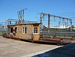
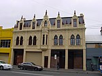
Macdonaldtown is an urban place in Sydney, in the state of New South Wales, Australia. It is 4 kilometres south-west of the Sydney central business district, adjacent to the suburbs of Newtown, Eveleigh and Erskineville. Macdonaldtown is part of the local government area of the City of Sydney and informally part of the region of the Inner West. The locality is around Macdonaldtown railway station, on the Inner West line of the Sydney Trains network.
Excerpt from the Wikipedia article Macdonaldtown, New South Wales (License: CC BY-SA 3.0, Authors, Images).Macdonaldtown, New South Wales
Pine Street, Sydney Newtown
Geographical coordinates (GPS) Address Nearby Places Show on map
Geographical coordinates (GPS)
| Latitude | Longitude |
|---|---|
| N -33.896886 ° | E 151.186767 ° |
Address
Platforms 1 & 2
Pine Street
2042 Sydney, Newtown
New South Wales, Australia
Open on Google Maps


