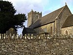
Cefn Eglwysilan
Marilyns of WalesMountains and hills of Caerphilly County BoroughMountains and hills of Rhondda Cynon Taf

Cefn Eglwysilan is a hill in South Wales, the twin 382m summits of which lie 2 km east of Pontypridd in Rhondda Cynon Taf county borough. Its eastern side lies within the community of Aber Valley in Caerphilly county borough. Like neighbouring Mynydd Eglwysilan, the hill is named after the hamlet of Eglwysilan, the church here being dedicated to an obscure saint Ilan. A wireless transmission station is sited on the more northerly of the two summits (at OS grid ref ST 099911). The southerly one is crowned by a trig point.
Excerpt from the Wikipedia article Cefn Eglwysilan (License: CC BY-SA 3.0, Authors, Images).Cefn Eglwysilan
Eglwysilan Road,
Geographical coordinates (GPS) Address Nearby Places Show on map
Geographical coordinates (GPS)
| Latitude | Longitude |
|---|---|
| N 51.6061 ° | E -3.3052 ° |
Address
Eglwysilan Road
CF83 4EQ , Aber Valley
Wales, United Kingdom
Open on Google Maps


